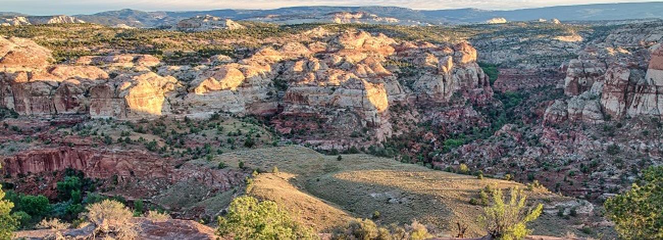
Utah National Conservation Lands
- National Monuments
-
The Bureau of Land Management manages three National Monuments in Utah - Bears Ears National Monument, Grand Staircase-Escalante National Monument and Jurassic National Monument. Jurassic National Monument is the newest monument to Utah, designated through the John Dingell, Jr. Act on March 12, 2019.
- National Conservation Areas
-
BLM Utah manages three National Conservation Areas (NCAs). The most recent of the Utah NCAs is the John Wesley Powell that was designated on March 12, 2019, through the John Dingell, Jr. Act. This NCA is located in the Vernal Field Office and is intended to conserve, protect, and enhance significant historic, cultural, natural, scientific, scenic, recreational, archaeological, educational, and wildlife resources. The other two NCAs are located in the St. George Field Office: Red Cliffs and Beaver Dam Wash. Red Cliffs offers 60,000 acres of outstanding opportunities for human-powered recreation next door to the city of St. George. Beaver Dam Wash provides 63,000 acres of solitude and scenic beauty.
- National Scenic and Historic Trails
-
BLM Utah manages portions of three National Historic Trails. The California Trail was a mid-19th century highway for human movement to lures of gold and farmland in California. The Old Spanish Trail opened a land route across 19th century Mexico between the Tierra Adentro (the fabled, yet isolated place that would become New Mexico) and California's missions and burgeoning settlements. The Pony Express Trail was a cross-country route used by young men on horseback to carry the nation's priority mail from Missouri to California from 1860 to 1861. Now 150 years later, visitors can closely follow the historic route of the Pony Express across Utah's west desert on a maintained BLM National Backcountry Byway, stopping a various station sites and interpretive displays along the way. There is also a public campground located at the Simpson Springs open year-round, and the route also goes through the Fish Springs National Wildlife Refuge.
- Wild and Scenic Rivers
-
The John Dingell, Jr. Act, signed into law on March 12, 2019, added 63 miles of the Green River to the National Wild and Scenic Rivers System under the following classifications:.
Wild River Segment - the 5.3-mile segment from the boundary of the Uintah and Ouray Reservation, south to the Nefertiti boat ramp.
Recreational River Segment - the 8.5-mile segment from the Nefertiti boat ramp, south to the Swasey’s boat ramp.
Scenic River Segment- the 49.2-mile segment from Bull Bottom, south to the county line between Emery and Wayne Counties.
Eleven river segments totaling 19 miles of the Virgin River drainage are managed by BLM Utah and all are classified as "wild". Each of the segments flows into or out of Zion National Park and a majority are within wilderness areas designated in 2009 by P.L. 116-9.
Read more about Virgin WSR segments.
- Wilderness
-
BLM Utah currently administers 35 wilderness areas. These areas are special places essentially undisturbed by human activities. Primitive recreational activities, such as hiking, backpacking, camping and fishing is permitted in these areas. Time spent in the wild can be therapeutic and inspirational - it can restore our connection to nature.
- Beartrap Canyon
- Beaver Dam Mountains
- Big Wild Horse Mesa
- Blackridge
- Blackridge Canyons
- Canaan Mountain
- Cedar Mountain
- Cold Wash (Coal Wash)
- Cottonwood Canyon
- Cougar Canyon/
- Doc's Pass/ Slaughter Creek
- Deep Creek/ Deep Creek North
- Desolation Canyon
- Devils Canyon
- Eagle Canyon
- Goose Creek
- Horse Valley
- Labyrinth Canyon
- LaVerkin Creek
- Little Ocean Draw
- Little Wild Horse Canyon
- Lower Last Chance
- Mexican Mountain
- Middle Wild Horse Mesa
- Muddy Creek Paria Canyon/ Vermilion Cliffs
- Red Butte
- Red Mountain
- Reds Canyon
- San Rafael Reef
- Sids Mountain
- Taylor Creek
- Turtle Canyon
- Wilderness Study Areas
-
BLM Utah administers 77 Wilderness Study Areas encompassing millions of acres. From 12,000-foot peaks to deep slot canyons, Wilderness Study Areas provide the intrepid hiker or backcountry horseman with views of unique rock formations, opportunity to glimpse sensitive species and walk in the footsteps of dinosaurs, ancestral peoples and early pioneers.
- Behind the Rocks
- Black Ridge / Canyon West
- Book Cliffs/ Mountain Browse ISA
- Bridger Jack Mesa
- Bull Canyon
- Bull Mountain
- Burning Hills
- Butler Wash
- Canaan Mountain
- Carcass Canyon
- Cheese Box Canyon
- Coal Canyon
- Conger Mountain
- Cross Canyon
- Daniels Canyon
- Dark Canyon / ISA Complex
- Death Ridge
- Deep Creek Mountains / Scott's Basin
- Desolation Canyon
- Devils Garden ISA
- Diamond Breaks
- Dirty Devil
- Escalante Canyons Tract 1
- Escalante Canyons Tract 5
- Fiddler Butte WSA
- Fifty Mile Mountain
- Fish Creek Canyon
- Fish Springs
- Floy Canyon
- Flume Canyon
- Fremont Gorge
- French Spring-Happy Canyon
- Grand Gulch
- Grandstaff Canyon
- Horseshoe Canyon (North)
- Horseshoe Canyon (South)
- Howell Peak
- Indian Creek
- Jack Canyon
- King Top
- Link Flats
- Little Rockies
- Lost Spring Canyon
- Mancos Mesa
- Mill Creek Canyon
- Moquith Mountain
- Mount Ellen-Blue Hills
- Mount Hillers
- Mount Pennell
- Mud Spring Canyon
- Mule Canyon
- North Escalante Canyons
- North Fork Virgin River
- North Stansbury Mountains
- Notch Peak
- Orderville Canyon
- Paria-Hackberry
- Parunuweap Canyon
- Phipps-Death Hollow
- Road Canyon
- Rockwell
- Scorpion
- Scott's Basin
- Sego Lily
- South Needles
- Spring Creek Canyon
- Spruce CanyonSteep Creek
- Swasey Mountain
- The Blues
- The Cockscomb
- Wah Wah Mountains
- Wahweap
- West Cold Spring
- Westwater Canyon
- White Rock Range
- Winter Ridge
