Nevada Frequently Requested Maps
The BLM manages nearly 48 million acres of public lands in Nevada, representing about 63 percent of the state. Located across Nevada, these lands are varied, as are their uses. Nevada’s public lands feature some of the most spectacular and productive acreage in the world.
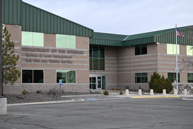
Find Your Local Office
Our most popular map! Put in a GPS coordinate or address and go. Use the map layers to check which agency manages the location, or click on the map to see the contact information for your local office. Click the icons in the upper right corner for more map features.
View Interactive BLM NV Office Boundaries Map in Full Screen
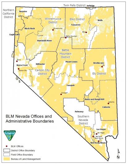
Print a District Map
BLM Nevada is organized into six management districts: the Winnemucca District, Elko District, Carson City District, Battle Mountain District, Ely District, and Southern Nevada District.
A small portion of Nevada is managed by BLM California through their Northern California District Office (in the northwest corner of Nevada).
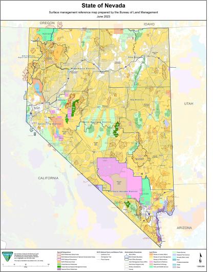
Print a Surface Management Map
The 2023 Surface Management Map is a high-resolution PDF, best recommended to print on 11x17 paper or larger.
Active Wildfire Maps
Find the most up-to-date wildland fire information in Nevada. Learn about wildfire prevention, preparedness, and current fire restrictions at Nevada Fire Info, which includes:
- Active Fire Maps - Nevada Fire Map
- Wildfire Cameras - Nevada Fire Camera
- Large Fire Updates - InciWeb
Free Mobile Maps
The mobile map program allows anyone to access maps on Android or Apple devices, even when they are offline.
BLM’s Enterprise Geospatial Services Team is developing these maps for 18 western U.S. states. The project will later expand to include all 50 states and, potentially, U.S. territories.
Learn about the National Mobile Map Package
Georeferenced Maps
These maps are designed for use on your mobile device and can be displayed on any PDF reader. Each map is geo-referenced so that your current location can be displayed on screen in real time.
View Nevada's Georeferenced Maps

Maps for Purchase
Contact us by phone, e-mail, or in-person to learn which maps are available.
- Surface Management Status 1:100,000 Scale Topographic Maps
- U.S. Geological Survey Topographic Maps
Mining Plats and Land Records
Nevada Land Records is a search tool that allows you to look up surveys, field notes, master title plats and more.
- Search by Township, Range, and Meridian on Nevada Land Records Search
The Mineral & Land Records (MLRS) online platform is an even bigger database of mining maps and land records.
- MLRS Login and FAQ and Videos.
Searching outside of Nevada? There are more land record databases.
Additionally, contact us for help with all types of mining assistance.
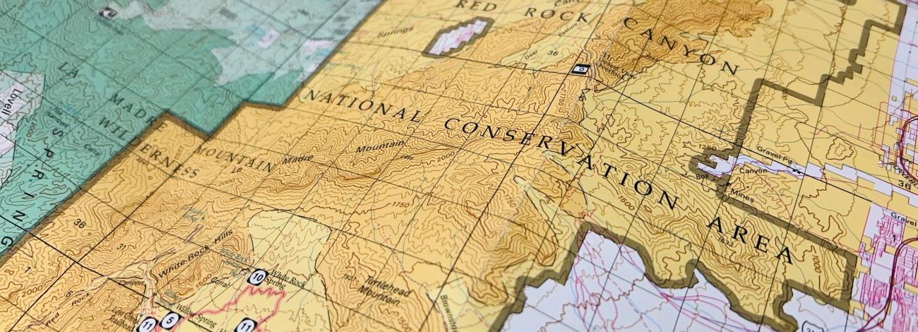
Recreation Maps
With over 48 million acres of public land, recreation is one of our favorite BLM activities. Most BLM land offers free dispersed camping with a stay limit of 14-days. Find more information, along with tips and regulations at Nevada Recreation Activities
Use the Interactive BLM Recreation Opportunities Map.
GPS coordinates and change the layers in the National Data Viewer map.
Wild Horse and Burro HMA Maps
BLM Nevada manages 83 wild horse and burro herd management areas on approximately 15.6 million acres. The combined appropriate management level for all HMAs in the state is 12,811 animals
Maps of Herd Areas and Herd Management Areas by State.
Learn about Nevada's Herd Management Areas.
Print a BLM Administrative Boundaries Map
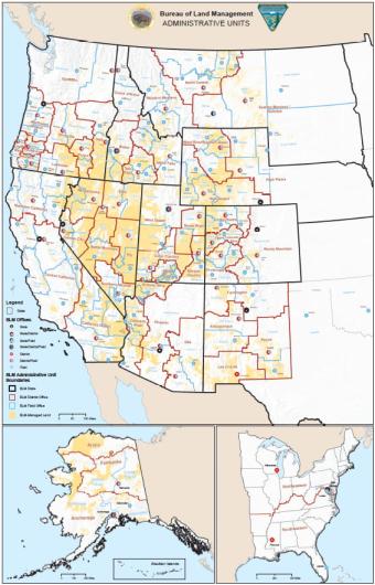
The BLM manages one in every 10 acres of land in the United States, especially in the West. The administrative boundaries show which office can help you utilize public lands.
Download a PDF:
11" x 17" | 21" x 23" | 24" x 36" | 36" x 40"
Contact Us
Public Room
Address: 1340 Financial Blvd. Reno, NV 89502
Email: [email protected]
Phone: 775-861-6500
Fax: 775-861-6606
Hours: 8 a.m. - 4 p.m. M-F