
New Mexico Hunting/Recreation Maps
November 25, 2025 update:
The Bureau of Land Management’s award-winning New Mexico Hunting/Recreation Maps program updates were paused in June 2022.
The old maps have been removed from both the app and the CarryMap website. These maps are no longer maintained and contain outdated information. We want to ensure you have access to the most current and accurate data available.
Due to changes in personnel and software, CarryMap is no longer used by the BLM. In its place, we now offer a free, modern alternative with expanded coverage and regular updates.
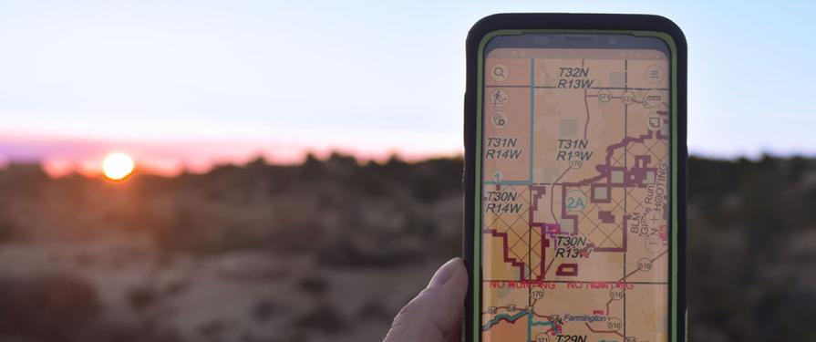
The program has transitioned to the BLM’s National Recreation MMPK System, accessible through the ArcGIS Field Maps app. The app is free to use, requires no login (just tap “Skip Sign In”), and provides full statewide maps for all western BLM states: Alaska, Arizona, California, Colorado, Idaho, Montana, North Dakota, South Dakota, Nevada, New Mexico, Texas, Kansas, Oklahoma, Oregon, Washington, Utah, and Wyoming.
These maps are updated quarterly, include national datasets, and continue to grow with each release.
For more information and instructions on how to use it, please visit National Mobile Map Package (MMPK) Program | Bureau of Land Management
We sincerely thank you for your support of the original program over its 10-year run. We are excited to have you explore and enjoy the new system.