
BLM recreation sites available to all: Exploring accessibility on Arizona’s public lands
The Expanding Public Lands Outdoor Recreation Experiences (EXPLORE) Act is designed to improve access to outdoor spaces, especially for people with disabilities, veterans, and children. In support of that law, for the next year, we will go state by state to discover accessible public lands managed on behalf of the American people by the Bureau of Land Management.
This month, we’re looking at Arizona public lands accessible to visitors with disabilities and their families. Some of these lands offer recreational target shooting, birdwatching, opportunities to learn more about our history, and more.
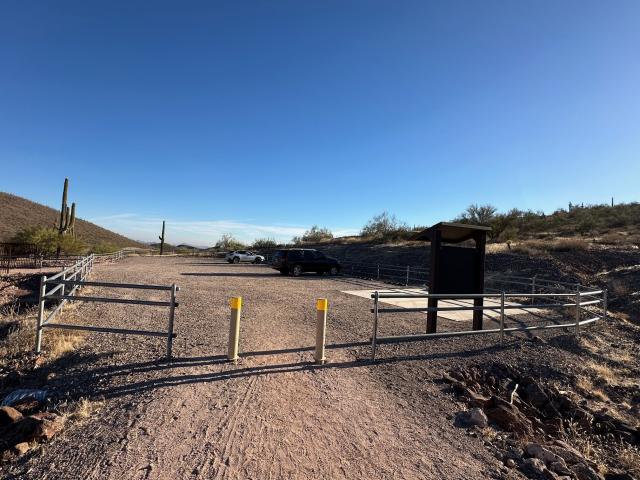
Accessible Recreational Shooting Sites – Central Arizona – Phoenix District Office
BLM recently built four accessible recreational shooting sports sites on public lands near the Phoenix metro area. Three of them – Baldy Mountain, Church Camp Road, and Saddleback Mountain – are north of Phoenix, while Box Canyon is south of town. All four sites have dedicated accessible parking spaces that are signed and striped with a concrete surface and have an access aisle for vehicles with a side ramp and other accessibility features.
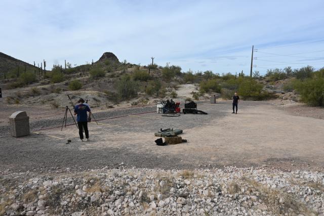
The popular Church Camp Road Recreational Shooting Site is the largest and most developed. It has three shooting bays with fixed steel targets at 50, 100, and 200 yards for pistol and rifle shooting. The 100- and 200-yard bays include fixed metal and concrete accessible shooting tables. A wide concrete platform connects all the shooting bays. Church Camp also has a separate fenced-in area with two accessible picnic shelters and vault toilets.


The less developed Baldy Mountain and Saddleback Mountain are designed for long-range rifle shooting. Both contain shooting lanes with fixed steel targets at 200, 300, 400, and 500 yards. Baldy Mountain also has a 100-yard shooting lane. Saddleback Mountain includes a 700-yard shooting lane. These sites, while accessible, don’t have picnic areas, toilets, or shooting tables.
Box Canyon has 50-, 100-, 200-, and 300-yard shooting lanes with fixed steel targets for long-range rifles, shotguns, and pistols, as well as an area for clay or skeet shooting. This site has accessible toilets but no picnic areas or shooting tables.
Accessible Bird Watching – Southeast Arizona – Gila District Office
Now we’ll explore three sites in southeast Arizona, an area well-known for its excellent year-round birdwatching (or birding), that are recognized as globally important birding areas.
The Gila Box Riparian, San Pedro Riparian, and Las Cienegas National Conservation Areas shown on this map are excellent places to birdwatch, learn some history, relax, and enjoy the fresh air and riparian landscape.

Birding apps and printable bird lists, created by eBird – a collaborative enterprise managed by the Cornell Lab of Ornithology – can help visitors identify birds by their calls and keep track of them. With these tools and the accessibility features of these areas, how many birds can you add to your life list (those you’ve seen and identified in the wild for the first time over your lifetime)?
Gila Box and San Pedro are the United States’ only Riparian National Conservation Areas.
Gila Box Riparian National Conservation Area
The Gila Box Riparian National Conservation Area is an ecosystem with four waterways that run year-round: the Gila and San Francisco rivers and Bonita and Eagle creeks. Northeast of the town of Safford, you can drive along a scenic backcountry road that parallels the Gila River to get to the west entrance of the National Conservation Area.
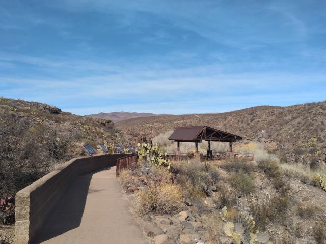
The Bonita Creek Watchable Wildlife Viewing Area has a shaded viewing deck with interpretive signs and benches on the canyon rim above the creek. How many of the more than 100 species of birds can you find? You can keep track with the Serna Cabin/Bonita Creek printable bird list. You might see the red flash of a Vermilion Flycatcher, hear the distinctive call of a Common Black Hawk, or witness a stealthy Great Blue Heron nab a fish with its long beak.
If birdwatching isn’t your thing, there are accessible picnic areas, campsites, and restrooms at the Flying W Group Day Use Site or nearby Riverview Campground. Accessible camping in a more remote area is available at the Owl Creek Campground, at the east entrance of the National Conservation Area. This small campground is off the Black Hills Back Country Byway, a 21-mile gravel road. This map shows the locations of these sites.
San Pedro Riparian National Conservation Area
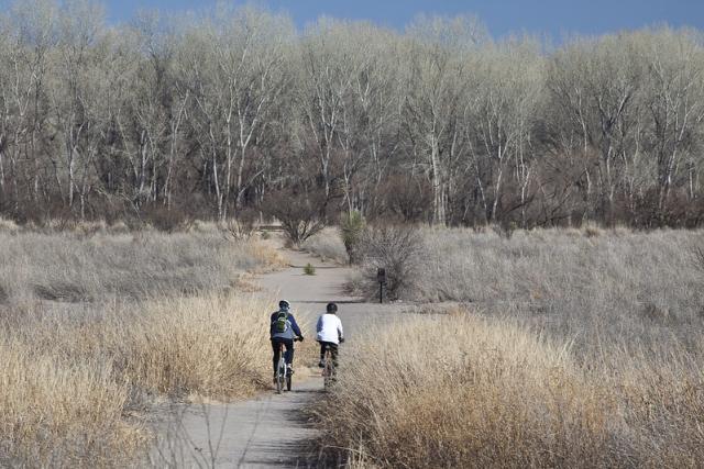
The San Pedro Riparian National Conservation Area is 137 miles southeast of Gila Box. It encompasses 40 miles of the upper San Pedro River. San Pedro House, Fairbank Historic Townsite, and trails to the river, shown on this map, are accessible features in the area that shouldn’t be missed.
San Pedro House, six miles east of the town of Sierra Vista, is an historic ranch house with a bookstore and gift shop. The Friends of the San Pedro River restored the ranch house, run the bookstore and gift shop, and lead tours around the site. The area has accessible picnic areas, restrooms, trails, and interpretive signs about the native plants and animals.
The trail leading from the San Pedro House to the San Pedro River is special to this author. Many years ago, after visiting other nearby sites that all seemed to have stairs, I wheeled my daughter to the river and lifted her from her chair so she could put her toes in the water, while birds sang happily all around us.
The American Bird Conservancy recognizes the area around San Pedro House as significant for world bird conservation, officially designating it as a Global Important Bird Area. Its accessibility makes it all the more special. As with Gila Box, visitors can keep track of the birds they identify using this printable bird list of more than 375 birds, bird apps, and bird books which can be found in the bookstore.
Fairbank Historic Townsite is a ghost town from the late 1880s with ties to the railroad and mining. Paved pathways lead from the parking lot to the schoolhouse and around the townsite, making it easy for visitors with disabilities to participate in the self-guided tour of this once-thriving boom town.
Visitors to both sites can play virtual Agents of Discovery Junior Ranger Missions, which are augmented reality games designed to accommodate different learning styles and programs. You can explore your surroundings and the native creatures at the San Pedro House or complete nine challenges about the history of the Fairbank ghost town. The Empire Ranch at Las Cienegas National Conservation Area also has a mission to discover the history of the ranch.
Las Cienegas National Conservation Area
Two accessible areas to explore at Las Cienegas are the Empire Ranch Headquarters and the Heritage Discovery Trail, managed in partnership with the Empire Ranch Foundation.
Like the San Pedro, Las Cienegas is considered a Global Important Bird Area. It has a printable bird list with 232 species. Cienegas means marshlands in Spanish, so it too provides riparian habitat, which is critical for wildlife in the dry, desert southwest.
Ten buildings make up the Empire Ranch Headquarters. Hardened pathways between buildings allow visitors to take a self-guided tour to learn about the site’s history. An 18-minute virtual tour, published by the Empire Ranch Foundation, allows you to explore the site without being there in person. It can help neurodiverse visitors who like to know what to expect when going to new places.
The Empire Ranch House is the centerpiece of the Empire Ranch Headquarters. Most of the 29 rooms in the house are accessible to visitors with limited mobility, though there are a few steps to get into the house. A place-based audio story about this area and several other places within the Cienega Watershed can be found on the TravelStories app. The audio launches automatically as you approach sites of interest.

The half-mile interpretive Heritage Discovery Trail is at the north end of the Empire Ranch Headquarters. Along this packed gravel trail, visitors learn the history behind the area, including the Hired Man’s House and the New Ranch House.
Those are just a few accessible sites on BLM-managed land in Arizona. Next month we’ll talk about some accessible sites in California.
BLM is dedicated to ensuring that everyone has an equitable opportunity to use their public lands by providing access to facilities, programs, services, and activities for people with disabilities. The BLM Accessibility Program provides details on opportunities, resources, laws, policies, and guidelines.
Related Stories
- Dark Sky Week: 12 spectacular BLM stargazing sites
- BLM Arizona Strip District volunteer immerses visitors in stories of the West
- On the Arizona Strip, Now is the Time for Fire and Fuels Work
- BLM recreation sites available to all: Exploring accessibility on California’s public lands
- A day on patrol with BLM Arizona Ranger Rocco Jackson
Office
One North Central Ave., Suite 800
Phoenix, AZ 85004-4427
United States