
The Bureau of Land Management celebrates the anniversary of the Dingell Act!
On March 12, 2019, the John D. Dingell, Jr. Conservation, Management, and Recreation Act (Dingell Act) became law. This legislation added new conservation designations, improved recreational access to public lands, permanently reauthorized the Land and Water Conservation Fund, and included other achievements. The Act includes more than 100 individual bills that were introduced by 50 Senators and several House members.
The Dingell Act added many new conservation-focused designations to some Bureau of Land Management (BLM)-managed lands, including 1,212,305 acres of wilderness, 48,478 acres of National Conservation Areas, the 850-acre Jurassic National Monument in Utah. Twelve new river designations and a total of 285 BLM river miles were added to the National Wild and Scenic River System through the Dingell Act.
As we celebrate the anniversary of the Act, we are happy to share some of the unique Dingell Act designations and impacts that you may not have heard about from across the Nation:
Alaska
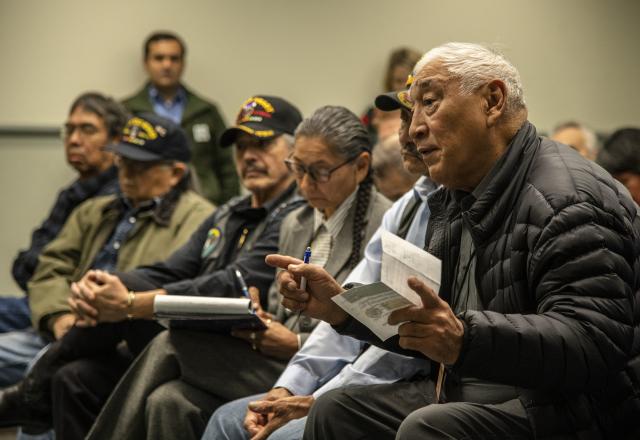
The Dingell Act created a five-year-long Alaska Native Veterans Land Allotment Program in 2019. This program is open and accepting applications from eligible veterans. The program provides the opportunity for eligible Vietnam-era veterans or their heirs to select 2.5 to 160 acres of Federal land in Alaska under the 2019 Dingell Act. The program is open to all eligible Alaska Natives who served between Aug. 5, 1964, and Dec. 31, 1971, and it removes the requirement for personal use or occupancy mandated under previous laws. Those receiving allotments under previous programs are ineligible.
The selection period is active until December 29, 2025, for the estimated 2,200 eligible veterans and heirs. 264 allotment applications have been received, 256 are in process, and the BLM is poised to receive more. Find out more about this program on BLM.gov.
Arizona
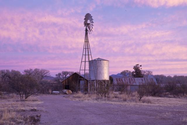
The Santa Cruz Valley National Heritage Area was designated in the Dingell Act. Its natural and cultural landscape is shaped by generations of people from diverse cultural origins. The area appeals to travelers of all ages seeking a respite from bustling city life.
Visitors to the Santa Cruz Valley National Heritage Area enjoy outdoor recreation, bird-watching, astronomy, heritage site tours, and local wineries and heritage foods. It includes attractions like the BLM's Las Cienegas National Conservation Area, and Juan Bautista de Anza National Historic Trail, which parallels the Santa Cruz River. Other attractions include: Catalina State Park, Saguaro National Park, Mission San Xavier del Bac, Tubac artist colony, Tubac Presidio State Historic Park, Tumacácori National Historical Park, Historic Canoa Ranch, Wild Chile Botanical Area, Patagonia Lake State Park, Madera Canyon and the Santa Rita Mountains, and San Rafael State Park and Natural Area.
California
Congress designated the Alabama Hills as a National Scenic Area in the Dingell Act in addition to outstanding wilderness, adding wild and scenic river miles, and other designations. The Alabama Hills are a formation of rounded rocks and eroded hills set between the jagged peaks of the Sierra Nevada and the geologically complex Inyo Mountains. Both geologic features were shaped by the same uplifting occurring 100 million years ago. The hills are located west of Lone Pine and are managed by the BLM.
Visitors enjoy touring film sites, photography, rock climbing, exploring natural arches, and viewing the swaths of wildflowers that bloom every spring. Learn more about the Alabama Hills on BLM.gov.
Idaho
In Idaho, the Dingell Act helped resolve some important boundary and administrative challenges on BLM-managed public lands. As a result of the Dingell Act, the BLM granted Fall River Electric a right-of-way of approximately 0.4 acres, which includes an electric distribution line and access road; has conveyed 0.5 acres of federal land for fair market value within the Henry’s Lake Wilderness Study Area; and has identified 126 parcels of public land in Idaho with recreational potential but with no or restricted public access. Additionally, the BLM has provided cadastral survey and realty assistance to the Bureau of Reclamation to convey parcels of land to two irrigation districts as part of a transfer of ownership of federal irrigation facilities related to the Minidoka Project in southeastern Idaho.
New Mexico
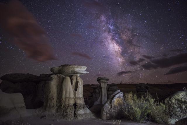
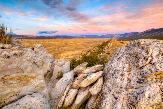
In New Mexico, the Dingell Act designated approximately 270,000 new acres of BLM managed wilderness. The new wilderness include East Potrillo Mountains, Mount Riley, Cinder Cones, Aden Lava Flow, Organ Mountains, Broad Canyon, Potrillo Mountains, Robledo Mountains, Sierra de las Uvas, Whitethorn, Cerro del Yuta, Rio San Antonio, and Ah-Shi-Sle-Pah wilderness. Each area is unique and offers an insight into the some of the remarkable untouched landscapes managed by the BLM in New Mexico.
One of the new areas designated by the Dingell Act, the Ah-shi-sle-pah Wilderness located in northwestern New Mexico is a badland area of rolling water-carved clay hills. The area is rich in fossils and has little vegetation to conceal geological formations. The thin vegetation includes sagebrush, pińon-juniper, Great Basin scrubland, and grassland. It is a landscape of sandstone cap rocks and scenic olive-colored hills. Water in this area is scarce and there are no trails; however, the area is scenic and contains soft colors rarely seen elsewhere.
Oregon-Washington
Among the spectacular new additions to the National Landscape Conservation System in Oregon/Washington the Dingell Act included the designation of approximately 200 miles of wild and scenic rivers in the Coos Bay, Medford, and Northwest Oregon Districts. These wild, scenic, and recreational segments are spread across 48 new river designations. The Act designated the first wilderness area in the BLM's Coos Bay District, the Devil’s Staircase Wilderness. In central Oregon the Act adjusted the extent of the Deschutes Canyon-Steelhead Falls Wilderness Study Area boundary. In Washington State the Act directed BLM to work with the U.S. Forest Service on a 340,079-acre mineral withdrawal. This withdrawal is entirely on National Forest lands in the upper Methow River drainage within the Okanogan/Wenatchee National Forest.
Utah
In Utah, the McCoy Flats was the first nationally designated mountain bike trail system, which affords riders of all abilities over 58 miles of interconnecting loops, flowing single track and technical rocky sections.
The Jurassic National Monument contains the densest concentration of Jurassic Era dinosaur fossils ever found, including over 12,000 bones from more than 70 different dinosaurs that have been excavated at the Cleveland-Lloyd Dinosaur Quarry.
The San Rafael Swell Recreation Area features magnificent badlands of brightly colored and wildly eroded sandstone formations, deep canyons, and giant plates of stone tilted upright through massive geologic upheaval. The San Rafael Swell has endless amounts of recreational experiences including off-highway vehicle riding, hiking, biking, horseback riding and river running.
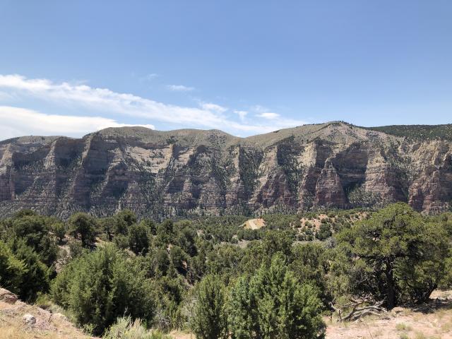
John Wesley Powell National Conservation Area is approximately 30,000 acres of potential paleontological discoveries, cultural sites, remote wildlife habitat, and stunning scenery. Designated by Congress during the 150th anniversary year of John Wesley Powell’s first expedition down the Green and Colorado Rivers, the NCA was set aside to protect and enhance historic, cultural, natural, scientific, scenic, recreational, archaeological, educational, and wildlife resources. It is home to critical greater sage grouse habitat, a large mule deer population, soaring raptors, annual elk migrations, historic ranches, and overlooks the bucolic oasis on the Green River known as Island Park in nearby Dinosaur National Monument. This unique area offers outstanding exploration opportunities for those looking for adventure and solitude. The majestic sandstone cliffs along the northern boundary above Jones Hole Creek are also remarkable see. The nearby Jones Hole National Fish Hatchery operated by the U.S. Fish & Wildlife Service uses water from underground springs that can supply up to 15,000 gallons per minute. The water temperature, 13 degrees Celsius (54 degrees Fahrenheit) year-round - the ideal temperature for rearing trout which are then used to stock regional lakes, rivers, and streams. The sandstone geology and natural ecosystem in the John Wesley Powell NCA are an important part of preserving the area’s water resources.
Related Stories
- BLM recreation sites available to all: Exploring accessibility on California’s public lands
- A day on patrol with BLM Arizona Ranger Rocco Jackson
- BLM recreation sites available to all: Exploring accessibility on Arizona’s public lands
- Overcoming challenges to move the BLM forward: Nikki Haskett
- A day in the life of a BLM Hobbs Petroleum Engineering Technician