
BLM Recreation Sites Available to All: Exploring Accessibility on Alaska’s Public Lands
The EXPLORE Act, or the Expanding Public Lands Outdoor Recreation Experiences Act, is designed to improve access to outdoor spaces, especially for people with disabilities, veterans, and children. In support of that law, for the next year, we will explore state by state to discover accessible public lands managed on behalf of the American people by the Bureau of Land Management (BLM).
Alaska manages approximately 70 million acres of public lands for the use and enjoyment of present and future generations. As you can imagine, most of these areas are remote, somewhat difficult to get to, and without many services. Even so, there are places where people with disabilities can go to experience these distant lands, including accessible viewing areas along the Steese Highway, accessible camping within Wild and Scenic River corridors, and a program that offers accessible fly-fishing opportunities for veterans.
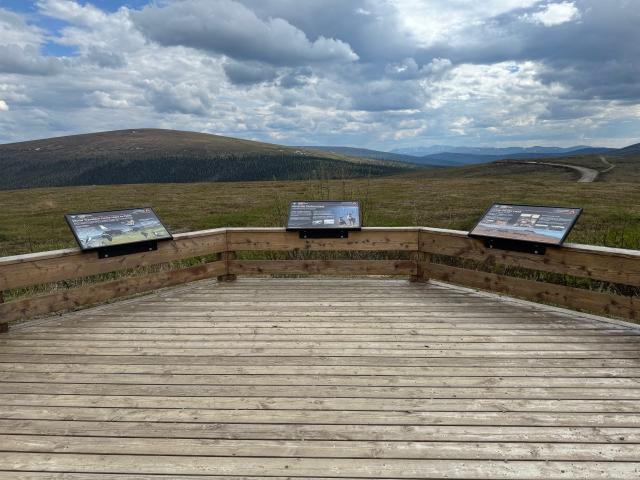
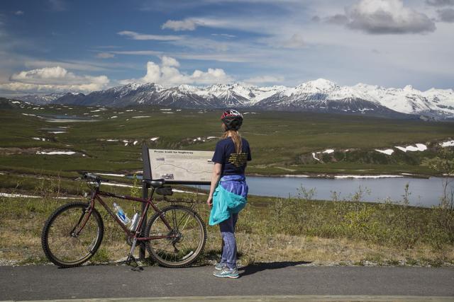
The Steese Highway (Alaska Route 6) starts in Fairbanks and heads 162 miles northeast, snaking between the North and South Units of the Steese National Conservation Area, and ending at the small town of Circle, Alaska. Although most recreation opportunities within the National Conservation Area are primitive and remote, two accessible viewing and interpretive platforms along the highway give visitors an opportunity to learn about the area and enjoy the views.
Twelvemile Summit Wayside at milepost 85.5 sits midway between Fairbanks and Circle. Eagle Summit Wayside is at milepost 107.1, and at 3,685 feet is the highest point along the highway. The map in the BLM’s Steese and Elliott Highways: Travel Guide brochure shows their locations.
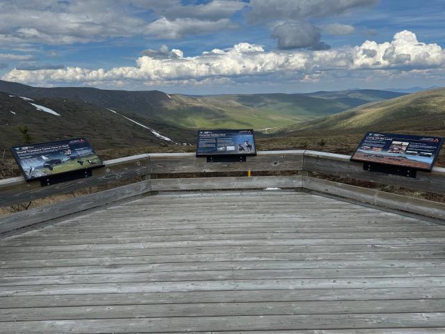
Both waysides have accessible viewing platforms with interpretive signs and expansive views of the Steese National Conservation Area. These waysides are popular places to look for the Northern Lights in the winter and they provide unobstructed views of the midnight sun during the summer solstice. The Eagle Summit viewing platform sits along an accessible ¼-mile trail loop with signs identifying various alpine tundra vegetation, allowing visitors with disabilities to experience the tundra more directly than looking down from above on the viewing platform.
If you enjoy camping, Alaska has accessible campsites at campgrounds within the Delta and Gulkana Wild and Scenic River Corridors, which are several hours south of the Steese National Conservation Area. The Delta River is classified as recreational (18 miles), scenic (24 miles), and wild (20 miles). All 181 miles of the Gulkana River are classified as wild. Learn more about these classifications on The National Wild & Scenic Rivers System website.
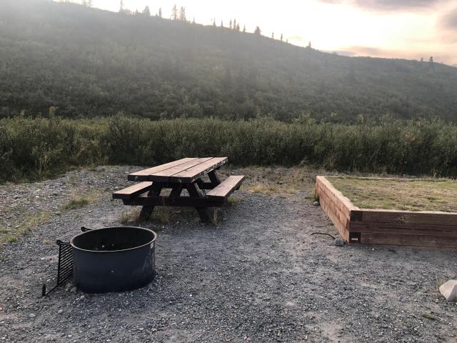
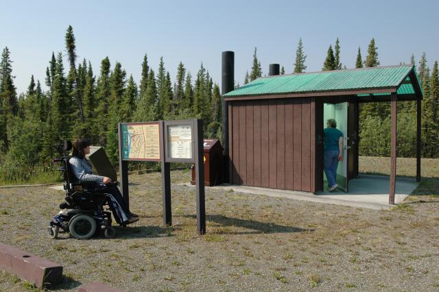
Tangle Lakes Campground is in the Delta Wild and Scenic River corridor, just north of the Denali Highway (Alaska Route 8) at milepost 21, as shown on the map in the Denali Highway Points of Interest Map & Guide. This campground has 50 campsites, including four walk-in sites and two group sites, all of which have some level of accessibility such as raised tent pads and accessible picnic tables that can accommodate visitors in wheelchairs. The campground has several accessible toilets as well as accessible fishing near the boat launch.
The Alaska Chapter of Project Healing Waters partners with the BLM to hold an annual fly- fishing trip at Tangle Lakes in June for disabled veterans. Project Healing Waters is a nonprofit organization that helps active military service personnel and veterans in need using fly fishing, fly casting, fly tying, and fly rod building.
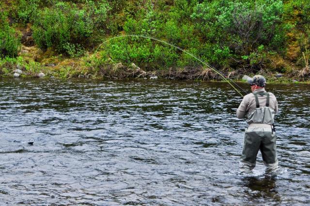
When asked about the trip, Sara Pate, Project Healing Waters’ Anchorage program lead said, “It’s an incredible opportunity for disabled veterans to have a world class fishing experience they wouldn’t get otherwise.” She went on to emphasize the value of bonding with fellow veterans from around the state for two days of fly fishing and camping at Tangle Lakes Campground. No electricity, no cabins, just camaraderie and lots of Arctic grayling.
For visitors who prefer picnics to camping, just half a mile south of the Tangle Lakes Campground is the Delta Wild & Scenic River Wayside. This day use area has an accessible picnic area, drinking water, toilets, and beautiful views of the Delta Wild and Scenic River.
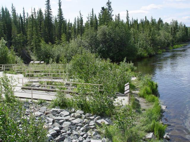
Southeast of the campground and wayside is the Gulkana Wild and Scenic River. Accessible camping and fishing are available at the Paxson Lake Campground and Sourdough Creek Campground at milepost 175 and 147.5, respectively, on the Richardson Highway (Alaska Route 4). The campgrounds and wild and scenic river corridor are shown on the map in the Gulkana Wild and Scenic River Map & Guide.
Both campgrounds have boat launches that are popular with boaters and anglers alike. Paxon Lake Campground is the primary launch point for those floating the main branch of the Gulkana Wild and Scenic River, and Sourdough Creek Campground is popular for the summer King salmon fishery. Visitors with limited mobility can fish from the boat launches at both campgrounds.
Each campground has more than 40 campsites. Two campsites at Paxon Lake and four at Sourdough Creek have some level of accessibility, including raised tent pads, double-walled grills, and picnic tables with extended tops to accommodate visitors in wheelchairs.
A one-mile accessible trail runs along the west side of the Sourdough Creek Campground, linking the accessible campsites north to the boat launch on Gulkana River, south to Sourdough Creek, and west to accessible fishing ramps where Sourdough Creek enters the Gulkana River.
So, although Alaska is wild and remote, people of all abilities can enjoy some of Alaska’s beautiful public lands managed by the BLM.
The BLM is dedicated to ensuring that everyone has an equitable opportunity to access their public lands by providing access to facilities, programs, services, and activities for people with disabilities. The BLM Accessibility Program provides details on opportunities, resources, laws, policies, and guidelines.
Related Stories
- Bringing the Past Forward: Jupiter History Day Festival at Jupiter Inlet Lighthouse ONA
- A petroglyph site in New Mexico combines raw natural beauty and human expression
- Historic high: Moab hosts the first U.S. Slackline World Cup
- Strengthening Shorelines, Sustaining Community at Jupiter Inlet Lighthouse ONA
- Legacy on the land: BLM Firefighter James Will Bennett's homesteading heritage in New Mexico
Office
222 W 7th Avenue #13
Anchorage, AK 99513
United States