
Simon Canyon Area of Critical Environmental Concern | New Mexico
Simon Canyon Area of Critical Environmental Concern (ACEC) is about 3,900 acres in size and is managed for semi-primitive forms of recreation including fishing, hiking, and backpacking. Development at the mouth of the canyon is minimal (with a parking lot, picnic table, and toilet) and provides the visitor an alternative to the more highly developed state park sites located nearby.
The sandstone canyon is characterized by moderately steep, to very steep, rough and broken terrain. Vegetation in the area is varied and ranges from shrubs, cactus species and cottonwood trees found at the canyon bottom, to piсon and juniper trees at upper elevations, with small scattered patches of Ponderosa pine and Douglas fir along the high canyon rim. Water from the small intermittent stream that flows down the canyon provides for areas of riparian plant communities.
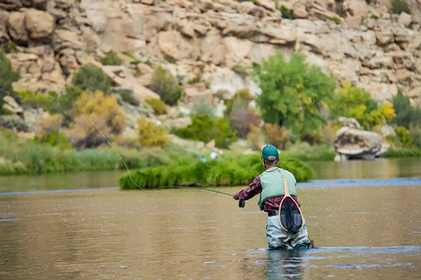
The diverse canyon landscape provides habitat for a variety of bird and mammal species such as the golden eagle, prairie falcon, great horned owl, porcupine, beaver, and deer. Local sportsmen and fishing enthusiasts from across the United States come to fish the Quality Waters of the San Juan River, including the stretch that flows past the mouth of Simon Canyon. Narrow trails winding along the river's edge will lead you to your favorite fishing spot.
The canyon also contains remnants of an earlier human occupation. Simon Canyon Ruin, a Navajo Pueblito, sits on a bench overlooking the canyon drainage. It is the only classic "boulder type" defensive site built north of the San Juan River and dates back to 1754. It consists of a well-preserved one-room structure built on top of a large boulder. Simon Ruin can be reached by taking a short hike up a steep dirt road past an active well location, then continuing on a foot path located along the bench overlooking the canyon drainage.
Photos
Accessibility Description (ABA/ADA)
The Simon Canyon ACEC area is a fairly undeveloped recreation space to protect cultural and natural resources. As a result, this area is fairly remote, has scarce services, and has limited facilities or trails which makes most of the area inaccessible unfortunately.
- To navigate the trail leading up to Simon Canyon Ruin or the trails lead to the campsite or water visitors must be able to hike across uneven terrain, around obstacles, and through weeds for at least a mile.
Know Before You Go
Fees
None
Facilities
There is no drinking water available at this site.
There is a large gravel parking area that can fit several cars, camper vans, and/or a handful of midsize RVs (under 30ft).
At the center of the parking lot are group picnic area and vault toilet are available.
At the rear of the parking area is the trailhead access for Simon Canyon Pueblito.
Another trail connects the parking area down to the water’s edge.
Camping
There are 4 primitive campsites that branch off the parking area.
Nearby Amenities
The nearest location to acquire gas, food, and water is in Bloomfield, ~23 miles away via Rd 4599 and US-64 W.
Seasons/Hours
Open year-round.
- The road may become difficult to impassible in inclement weather.
Special Rules
The Antiquities Act of 1906 and the Archeological Resources Protection Act of 1979 make it illegal to excavate, remove, damage, or deface archaeological resources. Penalties of up to five years in jail and a $250,000 fine can be imposed.
Collecting historical or archaeological artifacts from the area is not allowed.
Pets must be on a 6-foot leash and their waste disposed of.
No fireworks, discharge or use of firearms, or any other weapons in the campground, at the Pueblito, or on the water.
Practice Leave No Trace. Please make sure to carry out or dispose of any litter.
BROCHURES, MAPS, AND PUBLICATIONS
Wildlife in Area
Osprey
Bald eagles
Turkeys
Elk
Mule deer
Golden eagles
Flickr Album
 >
>
Contact Us

Activities


Addresses
Geographic Coordinates
Directions
Simon Canyon ACEC is north of the San Juan River, about 3 miles west of Navajo Reservoir. It is about 20 miles east of Aztec and Bloomfield, NM, and is generally accessible via US Highways 550 and 64 and State roads 173, 511, and 539. It can also be reached from the Colorado Stateline by taking NM 511 and NM 173. To reach the parking lot, turn north from NM 173 onto non-maintained County Road 4280. Follow the road about 3 miles from the turnoff to reach the parking lot.