
Chappie/Shasta Off-Highway Vehicle Recreation Area | California
Remember your OUTDOOR ETHICS when enjoying your public lands. Please RECREATE RESPONSIBLY.
Overview
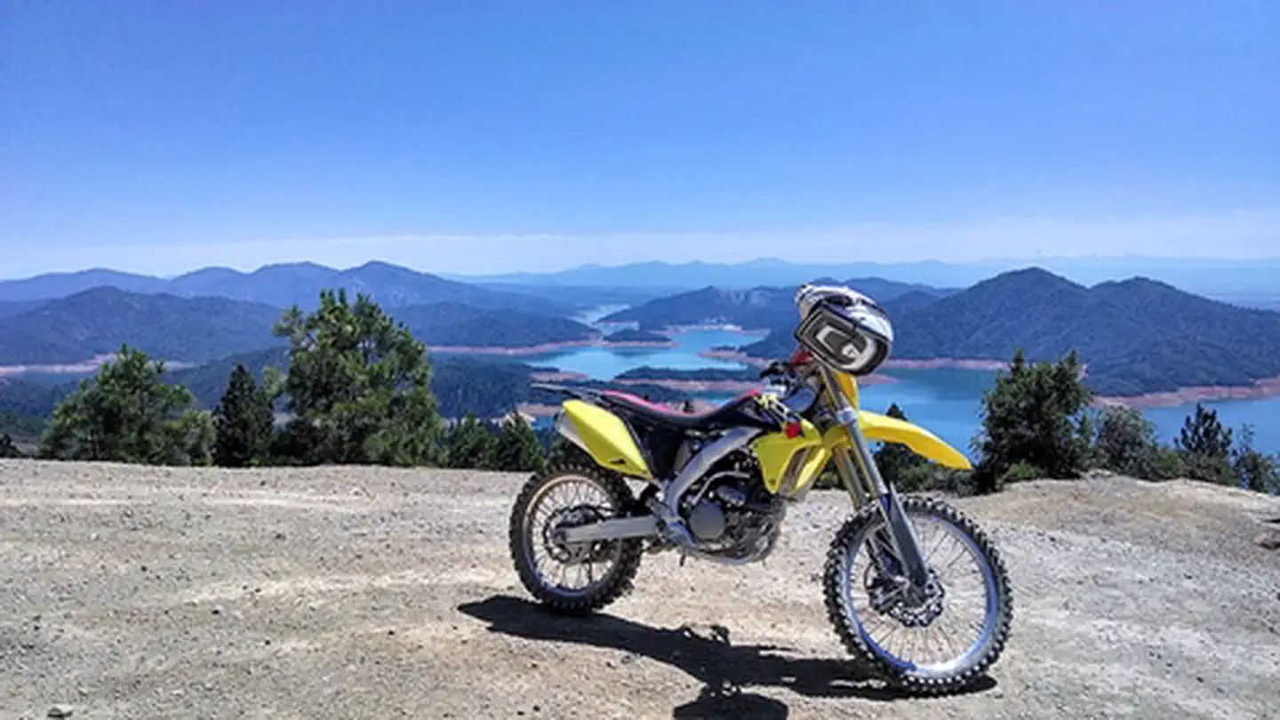
Visitors to the rolling, brushy hills near Shasta Lake in northern California will find off-highway vehicle (OHV) riding challenges for all abilities. More than 250 miles of roads and trails are open to motorcyclists, all-terrain vehicle drivers and four-wheelers. The area is near massive Shasta Dam and Shasta Lake, and there are overlooks of the Sacramento River below the dam. Wildlife species in the area include osprey, bald eagle, mule deer, and bear. This area was named after former U. S. Congressman, Eugene Chappie. The area is partially by the California State Parks OHV program.
Chappie/Shasta OHV Recreation Area is open year-round.
Need a Map?
- Chappie-Shasta Off-Highway Vehicle Area Northern Region
- Chappie-Shasta Off-Highway Vehicle Area Southern Region
Helpful Links
- To review current and past grants visit the: CA State Parks Website
- For information about ATV safety visit the: ATV Safety Institute
- For safety information or Recreational Vehicle training visit: Recreational Off-highway Vehicle Association
Nearby Attractions
For more OHV opportunities, visit these other BLM Managed Off-Highway Vehicle Areas located in Northern California and Nevada:
Photos

Accessibility Description (ABA/ADA)
View images of accessibility features in a new window.
The Staging Area site is partly paved with the rest surfaced in gravel. The paved area is nearest the entrance, and a large, gravel parking lot is to the left, southeast of the entrance road.
There is an accessible double vault toilet in the northeast corner of this parking area. An accessible water hydrant with an easy-to-use paddle valve (pushed right or left) sits on concrete next to the toilet.
Across from it is a pavilion with 6 picnic tables sitting closely together on a concrete pad, where space may be tight for users of wheelchairs and other mobility devices. There are also 6 benches without arms and 3 grills. One of these grills attaches to a firepit low to the ground, a 2nd is part of a concrete structure that may not be reachable from a sitting position, and a 3rd is a pedestal grill that sits on pavement and has 3 separate grilling units.
On the other side of the entrance road is a shaded information kiosk with trail maps and other site and safety information. This kiosk has a built-in bench.
To the north of the entrance is a large gravel lot with an elevated loading area used to load OHVs onto trucks or trailers. Another accessible double vault toilet and accessible water hydrant sit in the northeast corner of this large lot. There are also 2 concrete picnic tables and grills sitting on gravel near the elevated loading area.
The Staging Area is the access point for off-road trails of varying width, technical difficulty, and steepness. Generally speaking, trails in the area are a minimum of 4 feet wide. Some are wide enough to accommodate 2-way traffic; others are single-track only with traffic flowing in both directions. Any trail labeled single-track or ATV will only be able to fit 1 vehicle at a time. All trails are 2-way so there could be traffic traveling uphill and downhill at any given time.
Trails 76, 19, and 17 have a terminus at the Staging Area and could be accessed from the uphill terminus by shuttling up Rd 1.
There is no cell phone coverage at this site.
Note: Descriptions and photos uploaded March 2025. Please note that actual on-the-ground conditions may vary due to natural events (e.g., weather, wildfires, erosion), normal wear and tear, or site improvements.
Contact Us

Activities


Geographic Coordinates
Directions
Ten miles northeast of Redding, west of Shasta Dam. Take Interstate 5 to Shasta Dam exit. Travel west on Shasta Dam Boulevard to Shasta Dam. Continue west across dam, staying on paved road to the staging area.
Using Digital Maps on Mobile Devices
Heading out for a remote adventure? No cell coverage? No problem. The BLM has developed georeferenced maps compatible with any georeferenced map mobile application – Avenza Maps App being one of the more common.
The map available for this recreation area is georeferenced. For instructions on how to download and use georeferenced maps, and to access maps for other recreation areas, please visit https://www.blm.gov/maps/georeferenced-PDFs.
Please note that georeferenced maps are not a substitute for proper preparation and knowledge to travel on public lands. Always plan ahead and check the most up to date information and conditions before heading out.