
Riverbend Recreation Area and 1891 Schoolhouse | Arizona
In the Agua Fria National Monument, the Riverbend Recreation Area offers a peaceful setting along the Agua Fria River with rich pioneer history and wildlife viewing opportunities. Visitors enjoy open desert views, low-growing vegetation, excellent opportunities for bird and wildlife viewing, and a short (less than ¼ mile) walk to the historic schoolhouse foundation.
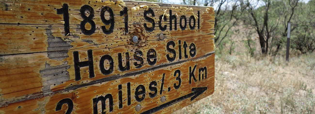
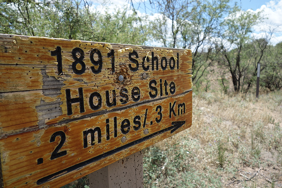
The 1891 Schoolhouse served local ranching and farming families until 1903. Though the building is gone, visitors can still see its rock foundation and learn about early education in Territorial Arizona. The site also reflects the broader history of settlement along the Agua Fria River and helps visitors imagine daily life for students who traveled long distances to attend school.
Hours and Seasons
Open year‑round. No restrictions or seasonal closures.
Features and Services
- Access and Parking: A gravel road leads to parking at the Riverbend Recreation Area. A short trail leads to the Schoolhouse foundation.
- Cell Service: Limited; expect spotty reception in this remote area.
- Toilets: None.
- Drinking Water: None.
- Pets: Allowed on leash; please pick up after your pet.
- Camping: Primitive, dispersed camping is permitted on nearby BLM lands; check local regulations for fire and camping guidelines.
- Nearby Amenities: Mayer and Cordes Lakes, about 10–15 miles away, offer food, fuel, lodging, and medical care.
Respect and Protect
Historic and archaeological sites are protected by law. Please leave artifacts where you find them and do not climb on walls or structures. By practicing responsible outdoor ethics, you help ensure future visitors can enjoy this remarkable site.
Photos
Accessibility Description (ABA/ADA)
Trail from parking is short and mostly flat, but the rocky terrain and uneven surface may be difficult to navigate. It would not generally be considered wheelchair accessible.
History of the 1891 Schoolhouse
What Once Stood Here?
On September 12, 1891, U.S. Deputy Surveyor Francis B. Jacobs recorded a schoolhouse at this location along the Agua Fria River. More than 118 years later, Jacobs’ map and field notes were rediscovered, sparking a renewed search for the school’s history and exact location. Based on the 1891 survey, the site became known as the “1891 Schoolhouse.” Using the map and field notes as guides, researchers identified the schoolhouse footprint. Although the building is gone, the sense of place remains. The site reflects the determination of Territorial Arizona settlers who wanted an education for their children. Students traveled long distances on foot, horseback, or by wagon to attend this one‑room school, where they learned, played, and built community.
No known photographs of the school survive. A Yavapai County Superintendent’s Report from 1889–1890 notes that the school had adequate grounds, good ventilation, limited furniture and equipment, no library, and a water closet.
Archaeological evidence, the partial rock foundation, historical records, and construction practices of the time suggest the building measured about 16 by 28 feet. It was likely a wooden-frame structure with a wooden floor on a stone foundation and vertical board siding. The school probably had several windows and a single entrance door, which was common for rural schools of that era.
The schoolhouse closed after the 1903 school year due to declining enrollment.
Who Attended and What Was School Life Like?
Built and supported by local families, the school was a symbol of hope for a better future. Most students came from nearby ranching and farming families, though some lived outside the district. Ages ranged from 6 to 18, and students learned at their own pace, with younger children often guided by older classmates. Enrollment ranged from 12 to 24 students between 1889 and 1903, with boys and girls attending in nearly equal numbers. Several students later became teachers themselves, and some even returned to teach at the same school.
The first documented school year began on September 9, 1889. A typical school year lasted five to eight months, starting on the second Monday in September. Classes ran from 9 a.m. to 4 p.m., with shorter days for younger children. Students enjoyed two 20‑minute recesses and played games such as ante‑over, steal sticks, and baseball. Lunch began at noon, and children ate meals brought from home in tin lard pails.
Along with standard subjects, students were taught principles of morality, truth, justice, patriotism, and the responsibilities of American citizenship. These lessons shaped young people during a period that ultimately led to Arizona statehood on February 14, 1912.
Learn more at the Friends of the Agua Fria National Monument website.
Contact Us

Activities


Geographic Coordinates
Directions
Riverbend Recreation Area and 1891 Schoolhouse are in the Agua Fria National Monument, about 40 miles north of Phoenix, Arizona.
From Cordes Lakes, go east on Quail Run Road, which leaves town and turns to a well-maintained dirt road. Continue 0.25 miles after the pavement ends. At the fork, bear left and follow the road toward the EZ Ranch. Continue 1.25 miles to the Riverbend Recreation Area and look for the BLM kiosk.
Fees
The 1891 Schoolhouse is free (no fee required) for general visits by the public.
However, commercial, competitive, and large organized group events require a special recreation permit. Contact the Hassayampa Field Office for more information about special recreation permits.