
Malheur River-Bluebucket Creek Wilderness Study Area
The Malheur Wilderness Study Area (WSA) (OR-2-14) is located 35 miles northeast of Burns, Oregon, and about 11 miles northwest of the community of Drewsey in Harney County. The WSA is 21 miles north of U.S. Highway 20.
The study area contains 5,560 acres, all of which is BLM land. It is shaped roughly like a horseshoe with an extremely irregular boundary configuration.
The boundary on the south, west and northeast is along legal subdivisions adjacent to private land. Part of the northern boundary abuts the Malheur National Forest, while the southeastern boundary is formed by a road. Also forming of the boundary are two dead-end roads, one which penetrates the WSA from the north for 2 miles; the other extending into the area for less than 0.5 mile from the east. The road that forms the southeastern boundary line and the two dead-end roads that enter the WSA and form additional segments of the boundary line, are all low standard dirt roads.
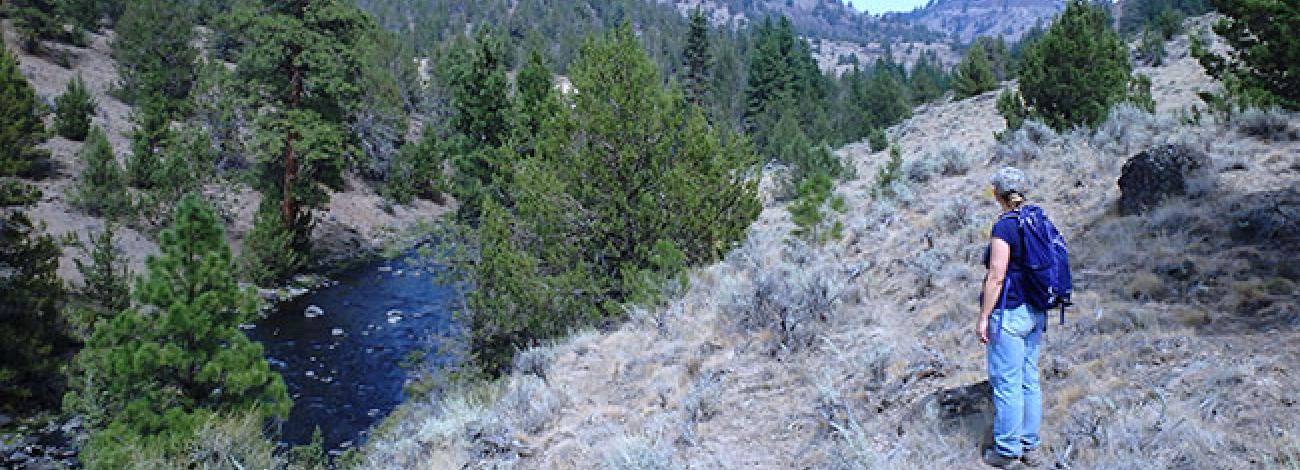
The topography is primarily a high tableland, deeply-cut by two major drainages: the Middle Fork of the Malheur River and Bluebucket Creek. The Middle Fork of the Malheur River is a perennial stream flowing from north to south through about 2.25 miles of BLM land.
The Middle Fork of the Malheur River Canyon is rugged and steep, with a depth varying from 600 feet in the north to 800 feet in the south. The canyon’s width varies from 0.5 to 1 mile. Bluebucket Creek, also a perennial stream, flows east to west, joining the Malheur River near the center of the WSA. Basalt forms the upper edges of the Bluebucket Creek Canyon walls which slope sharply to the bottom of the drainage.
West of the Malheur River Canyon, in the northern portion of the WSA, the terrain rises gradually to an elevation of 5,200 feet, the highest point in the WSA. This part of the study area is characterized by rolling hills and several small, intermittent streams which drain east into the Middle Fork of the Malheur River.
Battle Mountain, a relatively flat-topped plateau edged with forms the southwestern corner, or “leg” of the study area. The southern end of this plateau slopes down toward the southern boundary line where the WSA reaches its lowest elevation of 3,900 feet. Like Battle Mountain, Moffet Table to the east of the river and south of Bluebucket Creek is a relatively flat rimrock-edged plateau which forms the southeastern leg of the study area.
The WSA contains a variety of vegetation. Some of the most common species are big sagebrush, juniper, mountain mahogany and ponderosa pine.
The WSA was studied under Section 603 of the Federal Land Policy and Management Act (FLPMA), and was included in the final Oregon Wilderness Environmental Impact Statement (EIS) filed in February 1990.


