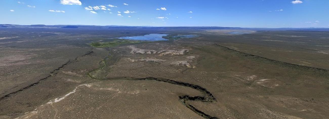
Guano Creek Wilderness Study Area
The Guano Creek Wilderness Study Area (WSA) (OR-1-132) is located approximately 67 miles northeast of Lakeview, Oregon, in southern Lake County. Oregon State Highway 140 passes 12 miles south of the WSA.
All of the 10,350 acres within the WSA are BLM land. The boundaries are defined by low standard dirt or gravel roads with the exception of approximately 1.5 miles along the eastern edge following the boundary of the U.S. Fish and Wildlife Service’s Shirk Ranch (fence) and an indentation of private land in the north.
The study area is characterized by open and gently roiling, sage-covered terrain which is broken by shallow intermittent drainages, rims, and the canyon of Guano Creek. There are two ephemeral sink lakes (geologic features created by circular depressions in the lava) in the northern portion of the WSA. Vegetation is primarily low sagebrush and bunchgrass communities, with riparian vegetation along drainages and Guano Creek, and juniper/ shrub associations scattered on upland areas.
There is a small stand of willow at the lower end of Guano Creek.
The WSA was studied under Section 603 of the Federal Land Policy and Management Act and was included in the Final Oregon Environmental Impact Statement (EIS) filed in February 1990.


