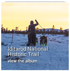
IDITAROD NATIONAL HISTORIC TRAIL
The Iditarod Trail is the only winter trail in the National Trails System and along with the Chilkoot, the two Congressionally designated National Historic Trails in Alaska.
The Iditarod National Historic Trail system is comprised of a 1,000-mile main trail between Seward and Nome, and an additional 1,400 miles of side/connecting trails that link communities and historic sites, or provide parallel route.
Congress established the Iditarod as a National Historic Trail in 1978. A May 17, 1978, Senate report noted that the trails comprising the Iditarod National Historic Trail “…offer a rich diversity of climate, terrain, scenery, wildlife, recreation and resources in an environment largely unchanged since the days of the stampeders. It is the isolated, primitive quality of this historical environment that makes the National Historic Iditarod Trail proposal unique. Nowhere in the National Trail System is there such an extensive landscape, so demanding of durability and skill during its winter season of travel. On the Iditarod, today’s adventurer can duplicate the experience and challenge of yesteryear.”
Today, BLM works with partners to maintain and promote the historic qualities that make the Iditarod unique among our nation’s National Historic Trails. As the designated Trail Administrator, BLM facilitates efforts by volunteers and local, state and federal agencies on behalf of the entire trail. BLM maintains about 200 miles of the trail, including five public shelter cabins. The trail segments that cross BLM-managed lands are managed as part of BLM's National Conservation Lands.
- Trail Management
Trail Management
Most of the historic Iditarod Trail is located on public lands managed by the State of Alaska or federal agencies (although some segments pass over private lands). No one entity manages the entire historic trail - management is guided by a cooperative plan adopted in the mid-1980s. The federal Bureau of Land Management coordinates cooperative management of the trail and is the primary point of contact for matters involving the entire trail.
Each year local groups, community clubs and individuals contribute their personal time and money to maintain and improve the Iditarod Trail. The statewide, nonprofit Iditarod Historic Trail, Inc., helps protect and improve the trail and keeps the "lore of the trail" alive.
Trail Ownership
Who owns the trail? The Iditarod is a complex trail system, stretching from Seward in the south, to Nome on the Bering Sea. It crosses lands owned by several Native corporations, municipal governments and the State of Alaska as well as federal lands managed by the BLM, the U.S. Forest Service, the U.S. Fish and Wildlife Service, and the Department of Defense. In all there are 10 institutional land managers and numerous private owners.
Bureau of Land Management
Anchorage Field Office
4700 BLM Road
Anchorage, Alaska 99507
Chugach National Forest
Seward Ranger District
334 4th Ave. P.O. Box 390
Seward, Alaska 99664Innoko National Wildlife Refuge
101 Front Street
P.O. Box 287 MS 525
Galena, Alaska 99741-0287State of Alaska Department of Natural Resources
550 W. 7th Avenue, Suite 1260
Anchorage, Alaska 99501-3557Alaska Division of Parks and Outdoor Recreation
18620 Seward Highway
Anchorage, Alaska 99516For further information about the Iditarod National Historic Trail System, contact the BLM Anchorage Field Office at (907) 267-1246 or toll free at (800) 478-1263.
- Iditarod National Historic Trail Comprehensive Management Plan Revision
Iditarod National Historic Trail Comprehensive Management Plan Revision
The Bureau of Land Management (BLM) Alaska State Office (AKSO), assisted by Logan Simpson as the Contractor, will revise the 1986 Comprehensive Management Plan (CMP) for the Iditarod National Historic Trail (INHT). The management situation has changed significantly since 1986 requiring revision of the plan to respond and anticipate contemporary and future changes. This CMP will revise and replace the 1986 CMP to renew the management objectives and goals to incorporate these significant changes, such as but not limited to land status, trail legal access, development of new infrastructure for the trail, and updates to public land and resource management decisions made since 1986, including Special Recreation Management Area and Visual Resource Management designations, National Trail Management Corridor, and travel and realty actions. The CMP revision will:
update the historic and contemporary routes that meet the Congressional Designated Purpose and Need;
update the list of inventoried High Potential Sites and Segments based on updated National Register of Historic Places records;
selection of a National Trail System Act Right of Way (defined as: the area selected by the National Trail administering agency in the trailwide Comprehensive Plan, which includes the area of land that is of sufficient width to encompass National Trail resources, qualities, values, and associated settings, and the primary use or uses. (BLM Manual 6280)1
incorporate updated wayfinding signage standards and site certification process; and
update interagency cooperation for plan implementation
Why Now
The current INHT CMP was finalized in 1986, making it nearly 40 years old. Considering that it is recommended that NHT CMPs are reviewed and revised periodically, the INHT CMP is well past the period of revision. These are the four main reasons why the revision is needed:
1. Changed Circumstances
Circumstances have changed since 1986 including resource and land management plan decisions regarding management of the INHT, changes in use, changes in land status and ownership along the INHT, and changes in partnership dynamics.
2. Documentation of New Information
Since 1986, the guidance on the nature and purpose statements for all national scenic and historic trails has evolved; we have new data on high potential sites and segments; we need to include a national trail right of way corridor; and there is a desire to incorporate information related to indigenous uses of the Trail.
3. Changed Landscape Conditions
The natural landscape and built environment have changed to a degree that requires revision of the CMP. For example, reduction in ice permafrost, spruce beetle kill impacts, reduction of average snowpack, new and growing villages and towns, energy exploration, and other pressures were not considered in 1986.
4. Changed Uses
Legal access to the INHT and the ways in which people utilize the INHT have changed dramatically since 1986. For example, commercial use of the INHT for events such as the Iditarod Sled Dog Race and other permitted events has only increased since 1986. Updated signage, marking, monitoring, and educational opportunities need to be included to guide implementation across all partners.
What the CMP does NOT do:
- Expand the Conservation System Unit (CSU) boundaries.
- Make a more restrictive plan.
- Mandate how non-BLM land managers/owners manage the land. All nonfederal land management is voluntary, but cooperation is sought.
- Acquire or identify acquisition for land parcels outside of willing sellers.
General Timeline
Summer 2025 - Existing CMP Analysis
Fall 2025 - Public Scoping
Winter 2025 – Prepare draft CMP revision
Spring 2026 – Public review of draft CMP/NEPA
Fall 2026 – Project completed
To learn more, please see the story map on this project at: https://arcg.is/0CbiWz0 or visit the FAQ here.
- Iditarod Trail History
Iditarod Trail History
Today’s Iditarod Trail, a symbol of frontier travel and once an important artery of Alaska’s winter commerce, served a string of mining camps, trading posts, and other settlements founded between 1880 and 1920, during Alaska’s Gold Rush Era. Alaska’s gold rushes were an extension of the American mining frontier that dates from colonial America and moved west to California with the gold discovery there in 1848. In each new territory, gold strikes had caused a surge in population, the establishment of a territorial government, and the development of a transportation system linking the goldfields with the rest of the nation. Alaska, too, followed through these same general stages. With the increase in gold production particularly in the later 1890s and early 1900s, the non-Native population boomed from 430 people in 1880 to some 36,400 in 1910.
In 1912, President Taft signed the act creating the Territory of Alaska. At that time, the region’s transportation systems included a mixture of steamship and steamboat lines, railroads, wagon roads, and various cross-country trail including ones designed principally for winter time dogsled travel. Of the latter, the longest ran from Seward to Nome, and came to be called the Iditarod Trail.
While marked off by an official government survey, in many places it followed preexisting Native trails of the Tanaina and Ingalik Indians in the Interior of Alaska. In parts of western Alaska east of Unalakleet and along the coast, it followed ancient routes traveled by the Inupiaq and Yupik Eskimos. Thus, Alaska Natives long used portions of what came to be today’s Iditarod Trail, and before the first non-natives came to Alaska had developed special winter modes of travel over it—the dogsled and snowshoe.
- Permitted Events
Permitted Events on the Iditarod Trail
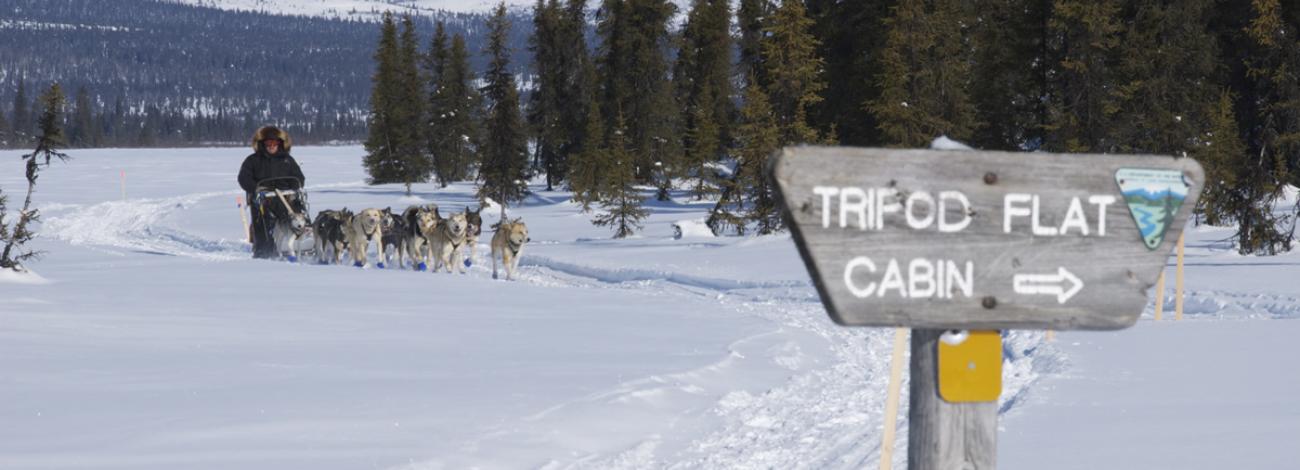
The Iditarod Trail has a rich history, but in this modern era it is known race event route.
Major race events that are permitted by the BLM are: the Iditarod Trail Sled Dog Race, the Iron Dog Snowmachine race, and the Iditasport ultra marathon for skiers, runners, and mountain bikers. Learn more about Special Recreation Permits.
QUICK LINKS
- Iditarod National Historic Trail FAQs
- FAQ for Iditarod National Historic Trail Comprehensive Management Plan Revision
- Storymap for Iditarod National Historic Trail Comprehensive Management Plan Revision
- Administrator's Report
- Iditarod Historic Trail Alliance
- Alaska Resources Library & Information Services (ARLIS) Iditarod Information
- Iditarod National Historic Trail Passport Program
Quick Facts
Congressional Designation
Trail Administrator: BLM
Created: 1978
Length: 2,400 miles
Iditarod National Historic Program
Bureau of Land Management
Anchorage Field Office
4700 BLM Road
Anchorage, Alaska 99507
907-267-1246