
Upper Missouri National Wild and Scenic River
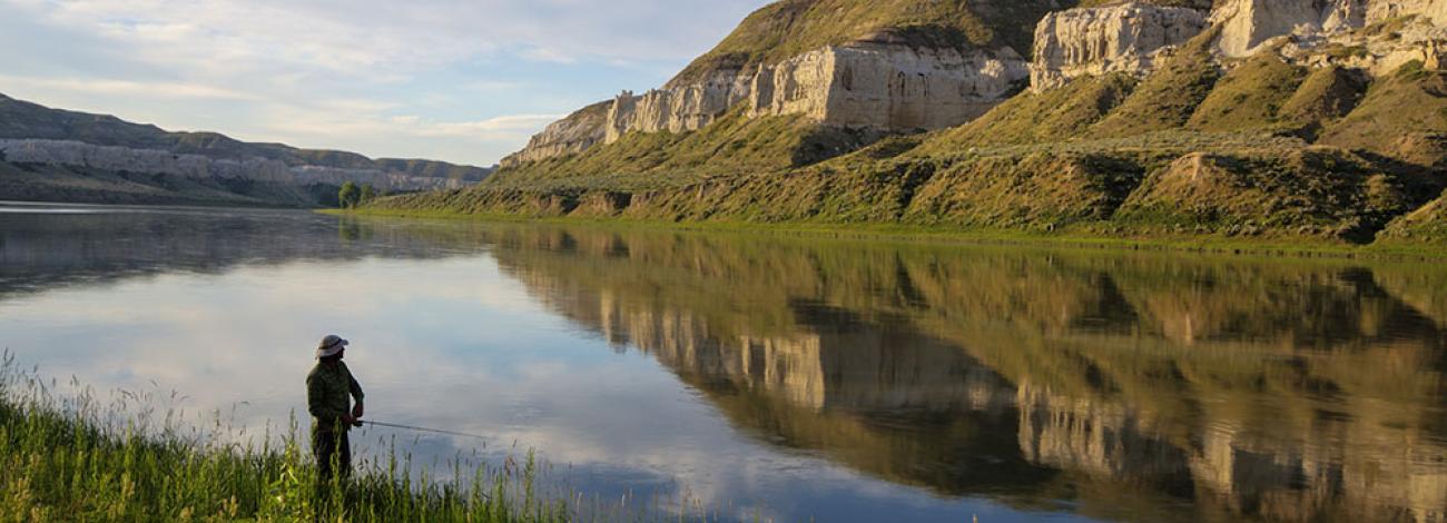
The centerpiece of the Monument encompassing a 149 mile section of river was first officially recognized by the State of Montana in 1966 as a component of the Montana Recreational Waterway System. The Upper Missouri’s uniqueness, special values and wild and scenic qualities were instrumental in the National Wild and Scenic designation on October 12, 1976. Of special note is the fact that the Upper Missouri contains segments of all three river classifications contained in the Wild and Scenic Rivers Act of 1968. These classifications are Wild, Scenic and Recreational. To this day the Upper Missouri remains relatively unchanged and its settings vary from riparian vegetation, to the unique and beautiful “White Cliffs,” to the sharply carved and rugged “Badlands,” to the rolling, pine and juniper covered slopes of the “Breaks.” These contrasting habitats provide for a diverse and plentiful wildlife population, numerous recreational opportunities, livestock grazing and other multiple use activities.
Find out more about other wild and scenic rivers on the State National Conservation Lands page or on the wild and scenic rivers program page.
-
River Recreation Facilities
-
Level 1: Developed Public Access Sites
Developed public access sites are accessible by road and have a full range of developments that could include parking lots, boat ramps, vault toilets, campsites for tents and RV's, and picnic facilities. These sites include Wood Bottom, Decision Point Interpretive Trail, Coal Banks, Judith Landing, Lower Woodhawk, and the James Kipp Recreation Area.
Level 2: Developed Boat Camps
Developed boat camps are accessible only by boat. The sites could include vault toilets, metal fire rings, and occasionally, open-air shelters. These sites include Little Sandy, Eagle Creek, Hole-in-the-Wall, and Slaughter River. The BLM has administrative road access to these sites.
Level 3: Primitive Boat Camps
Primitive boat camps are accessible only by boat and could contain a metal fire ring but no other developments. Theses sites include Evans Bend, Senieurs Reach, Black Bluff Rapids, Dark Butte, Pablo Rapids, The Wall, McGarry Bar, Gist Bottom, Cow Island, Upper Woodhawk, Missle Woodhawk, and Hideaway.
Level 4: Dispersed Camping Opportunities
In addition to the developed sites described above, camping is permissible on any of the 90,000 acres of BLM land adjacent to the river. The absence of development allows opportunities for those seeking a completely primitive experience. In many areas private land is intermingled with BLM Land and landowner permission is required to access or cross private land.
-
UPLAND RECREATION FACILITIES
-
Level 1: Developed Public Access Sites
Developed public access sites are recreation sites where a high level of development could include campsites, parking lots, vault toilets, interpretive signs, campground host facilities, tree plantings, picnic tables, waste facilities, and other infrastructure improvements that accommodate the transition from highway to collector roads. An example of a Level 1 site is the James Kipp Recreation Area located where U.S. Highway 191 crosses the Missouri River.
Level 2: Developed Upland Sites
Developed upland sites are campsites, trailheads, scenic overlooks and reservoirs where moderate levels of development could include metal fire rings, vault toilets, and improved gravel parking areas. Interpretive signs and information boards may be present but much less obtrusive than at Level 1 sites and would blend well with natural surroundings. These sites include FR Reservoir, Butch Reservoir, Spencer Road Overlook, Gazob Reservoir, Gilmore Cabin, Snake Point Overlook, and Sunshine Ridge Overlook.
Level 3: Primitive Campsites
Primitive campsites are pull-out sites immediately adjacent to a road. They may contain a fire ring but no other development.
Level 4: Dispersed Camping Opportunities
Public land in a natural state with no development present may be used for dispersed camping. These areas may be accessible by motorized or non-motorized travel.
-
MOTORIZED WATERCRAFT GUIDE
-
River Mile 0-52 Fort Benton to Pilot Rock (Recreation Segment):
Motorized watercraft travel both upstream and downstream will be allowed yearlong. The operation of personal watercraft and landing of floatplanes will only be allowed on river miles 0-3 yearlong.
River Mile 52-84.5 Pilot Rock to Deadman Rapids (Wild Segment):
Motorized watercraft travel downstream at a no-wake speed will be allowed from June 15 to September 15. Motorized watercraft travel both upstream and downstream will be allowed the remainder of the year, from September 16 to June 14. The Operation of personal watercraft and landing of planes will not be allowed yearlong.
River Mile 84.5-92.5 Deadman Rapids to Holmes Council Island (Recreation Segment):
Motorized watercraft travel both upstream and downstream will be allowed yearlong. The operation of personal watercraft and landing of floatplanes will not be allowed yearlong.
River Mile 92.5-149 Holmes Council Island to Fred Robinson Bridge (Wild and Scenic Segments):
Motorized watercraft travel downstream at a no-wake speed will be allowed on Thursdays through Saturdays from June 15 to September 15. Motorized watercraft travel will not be allowed on Sundays through Wednesdays from June 15 to September 15. Motorized watercraft travel upstream and downstream will be allowed the remainder of the year, from September 16 to June 14. The operation of personal watercraft and landing of floatplanes will not be allowed yearlong.