
Burnt Lodge WSA
Values
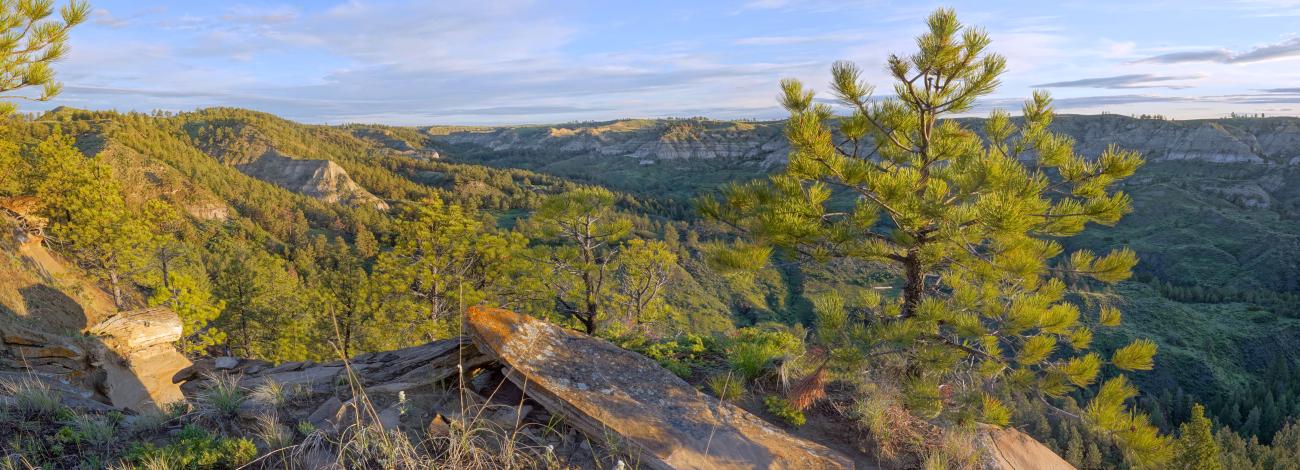
Burnt Lodge WSA is in the Missouri Breaks in the northern Great Plains. Numerous parallel ridges formed by coulees draining into the Missouri River characterize this area. The coulees create steep sided canyons with exposed shale and sandstone rock in Badland formations. Ridgetops and north-facing slopes are vegetated by prairie grasses and forbs along with scattered stands of ponderosa and Douglas fir. The landscape provides outstanding opportunities for solitude. Big game and upland bird hunting are popular activities here. Other recreation opportunities include hiking, backpacking, primitive camping, wildlife viewing, photography, and horseback riding. Burnt Lodge WSA is located in Phillips and Valley Counties along the northern boundary of the Charles M. Russell National Wildlife Refuge.
Visitation
From Malta, Montana, travel south on Highway 364 for four miles and turn left on South Black Coulee Road. Immediately turn right on Content Road. Follow Content Road south east approximately 6 ¼ miles and turn right on Sun Prairie Road. Follow Sun Prairie Road approximately 26 miles then turn left on Larb Hills Road (there is also a BLM sign for Larb Hills). Follow Larb Hills Road approximately 2 ¾ miles to a BLM Sign for Coal Mine Hill Rd and continue straight. Drive approximately 7 ½ miles turning right to stay on the public road. Drive approximately 1 ¼ miles turning right to stay on the public road. Drive approximately 6 miles to a parking area and trail on the left side of the road marked by green fiberglass posts. This parking area and trail is provided by the American Prairie Reserve, and allows for public access to the WSA at Cart Trail Coulee. The trail ends in about ¼ mile where BLM lands begin, and hiking from this point is cross country.
Visitor Advisory
The Burnt Lodge WSA is remote. More than 50 miles of driving on dirt roads is required to reach the WSA. When muddy the roads may be impassible. Road conditions can vary widely within a number of miles due to scattered rain moving through the prairie. Though the roads described in the directions above are periodically maintained, it is best to have 4WD and high clearance for wash outs and the slick “gumbo” that can form on the road after rain. Hiking in the WSA requires navigational skill as there are no trails.