Enhancing Wildland Fire Response: Modernizations to Wildland Fire IT
At the National Interagency Fire Center (NIFC), Fire and Aviation Information Technology (FAIT), works diligently behind-the-scenes upgrading and stabilizing applications that wildland fire personnel rely on daily. The improvements in data access and interoperability make for a more efficient and productive response in wildland fire management.
Over the past several years, FAIT has worked to upgrade applications to ensure consistency for application development and maintenance. The enhancement of the Smokejumper Modification Document System, known as MODOC, provides a formalized approval process for equipment, procedural, or policy changes related to the Bureau of Land Management (BLM) smokejumper aerial delivery systems. Included is a formalized approval process with risk assessment and oversight, historical tracking of changes, and studies or projects of relevance.

Wildland fire business leaders have seen an upgrade to the UnitID, or Unit IDx. This application provides them the ability to submit, review, and approve UnitIDs, making the data available through web services and allowing interactive visualization of identifiers for each fire dispatch unit at the local, state, and federal levels.
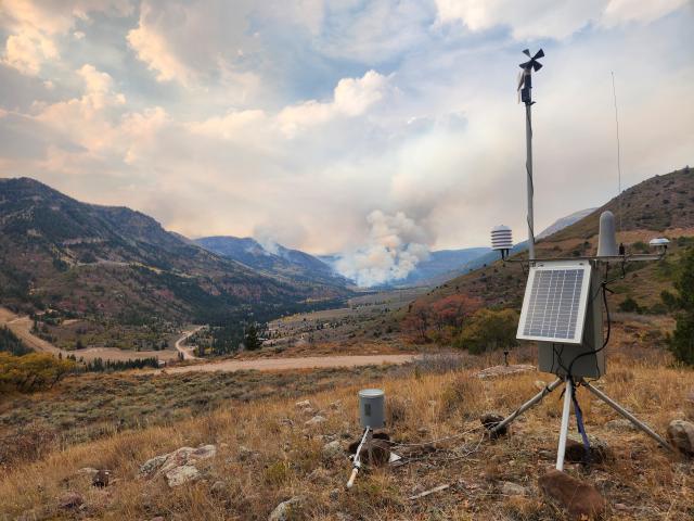
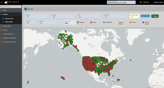
Wildland firefighters and decision makers rely on accurate, real-time weather forecasts to make safe, informed decisions. Remote Automatic Weather Station, or RAWS, operated by Department of the Interior, USDA Forest Service, and state agencies, utilize the WXx Weather application to support these decisions. WXx combines raw data with station metadata and distributes the near real time weather observations to downstream clients. Station metadata is maintained by users with appropriate access and updated station metadata information is distributed to the NIFC Asset Management System (NAMS) via database integration.

The NAMS application, used by the RAWS unit, tracks key data for the Remote Sensing Fire Weather Support Unit. It monitors maintenance performed on data loggers and sensors, technician work, parts inventory, data loggers and sensors in the field and at NIFC, maintenance job plans, post-trip narratives, equipment calibration, and reports on personnel, sensors, data loggers, and fire weather stations.

Have you ever wondered how IMT resources from federal, State, and private entities can come together to fight fires, everyone gets paid, and the expenses are tabulated from all the various accounting systems to arrive at an overall cost? A system called FireCode assigns a unique 4-digit identifier for every incident and exports that to the financial systems, which generate agency accounting codes for the specific incident.
Wildland fire agencies use the FireCode application to generate financial codes for fire incidents. Because wildfires cross jurisdictional boundaries, this system allows agencies to more accurately track suppression costs. FireCode distributes project identification numbers to agency financial systems and multiple wildland fire applications via the Integrated Reporting of Wildfire Information (IRWIN) system.
The Incident Qualifications and Certification System, or IQCS, is set for a new rollout in late fall 2025. This interagency application tracks incident responder certifications, produces red cards for all Interagency personnel responding to wildland fire and all hazard incidents, and provides workforce analytics for multiple entities, including the Bureau of Land Management, USDA Forest Service, Bureau of Indian Affairs, U.S. Fish and Wildlife Service, National Park Service, The Nature Conservancy, Department of the Interior All-Hazard Agencies, Department of Defense, and Department of Energy.
Another application of note is the Fire Equipment Use. FAIT developed FUSE to ensure that field managers can input equipment use statistics through a mobile application daily. The data is then available to state and national level program managers to assess the data and base decisions for fire preparedness and suppression.

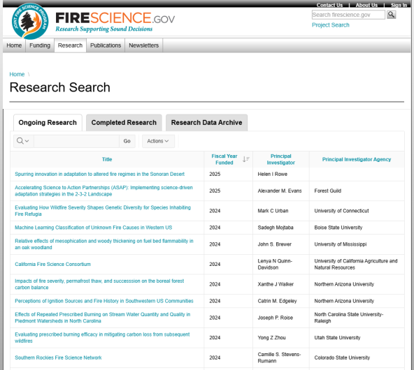
At the core of the Joint Fire Science Program (JFSP) mission is its database; a dynamic, interactive platform that serves as the backbone for managing fire science research efforts. For researchers, the database streamlines the process, allowing them to submit revisions, receive agreements and funding paperwork, and upload final reports and project deliverables. This integration of the database with the public-facing website ensures a transparent, real-time view of the research landscape, allowing everyone, from fire managers to the public, to stay updated on the latest findings and innovations in fire science.
The diligent and efficient work of the FAIT group allows for wildland firefighters and support personnel to focus on their task at hand, with up to date and compatible IT systems at their fingertips.
Andrea Good, BLM Fire Public Affairs Specialist
