BLM publishes interactive web map displaying access to public lands

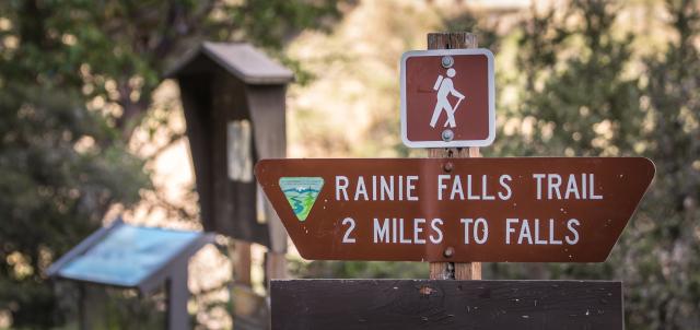
A brown and white trail marker that reads Rainie Falls Trail 2 Miles to Falls.
Rainy Falls trailhead, Oregon. Photo by Greg Shine.

Navigating public lands just got a lot easier.

In December 2024, the BLM released a new interactive web map that displays legal locations to access BLM-managed public lands.

BLM-managed public lands are often adjacent to private lands. The BLM created the Public Lands Access Data (PLAD) to help people better understand where to legally access public lands through easements. An easement is an agreement between private landowners and the BLM to use private land for a specified purpose, such as access to recreation opportunities.

“By working with private landowners, the BLM agreed on legal locations to access our public land. This new web map ensures the public can easily find those exact locations – making planning simpler for visitors and ensuring members of the public don’t inadvertently trespass on private land,” said PLAD program analyst Ashton Johnston.

The data published in December is BLM’s initial response to the 2022 MAPLand Act that requires public recreational access to federal land be digitized and published by April 2026. The data were created through research of lands and realty records to identify the legal access that currently exists, then modernizing (digitizing) the records into a Geographic Information System dataset.

For a safe and enjoyable visit to public lands, please ensure the roads and trails you travel are legally passable. Additionally, while mapped access provides a legal means to reach BLM-managed lands, it does not allow for other uses of the non-BLM lands crossed. Please recreate responsibly and remember to practice outdoor ethics to ensure all visitors have an enjoyable experience.

Find more information on the PLAD website.

Story by:

Allison Miller, Public Affairs Specialist

Blog Topic: