
AIMing High: AIM crew gathers soil and vegetation data from the Pryor Mountains in Montana
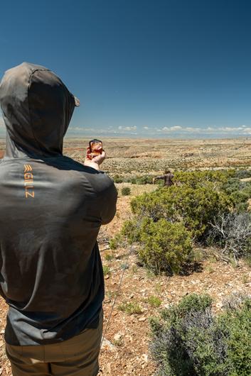
By truck, UTV, and foot, the Billings Field Office Assessment, Inventory and Monitoring (AIM) Crew recently found its way to an elevation of 5,500 feet in the Pryor Mountains.
Once there, the 3-person crew went into action, using the AIM Strategy to collect soil and vegetation data.
The AIM strategy provides a set of standards for assessing natural resource conditions and trends on BLM-managed lands. It provides quantitative data and tools to guide and justify policy actions, land uses and adaptive management decisions.
Gathering this data is no small task, so six years ago the BLM began cooperating with AIM crews from the University of Montana. Most Montana/Dakotas offices have an agreement with UM to collect AIM data.
“You can never have too much data,” remarked Jason Sprung, Geospatial Ecologist/Monitoring Coordinator for the Billings Field Office. “We use it for everything from grazing lease renewals, wildlife habitat assessments, and resource management planning.”
Early in the season, Sprung often accompanies the crew to provide additional on-the-ground training. He said the Billings crew surveys about 50 plots each season.
This year’s crew consists of UM students Isaac Odegard (ecology) and Josh Arave (forestry), and Francois De Wet, a wildlife biologist with more than two decades of experience in his native South Africa.
Lauren Sinclair, liaison between the BLM and UM, also accompanied the group to the Pryors. She is a botanist and a key player in overseeing the various crews and ensuring the data is collected properly and consistently.
“We have 15 crews working on BLM lands across Montana, Idaho and Wyoming,” she said.
The plots are randomly selected by a computer-generated algorithm. On this day, the designated plot was high in the Pryor Mountains on the wild horse range. Although no horses were present, it was evident they had been there.
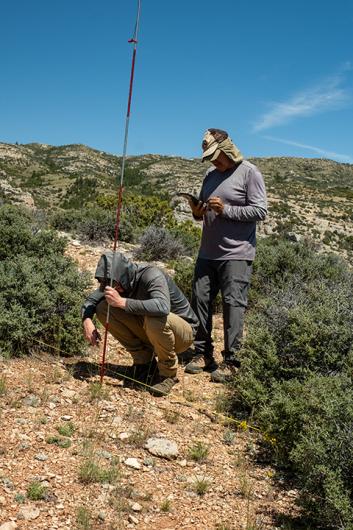
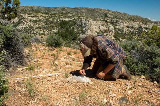
While two crew members laid out lines and recorded vegetation at evenly spaced points in a method known as line-point intercept, another crew member dug a hole to sample the soil. Normally this would have involved a hole 70 centimeters deep, but solid rock allowed a depth of only 8 centimeters. The soil is shallow but healthy. Despite limited annual precipitation, shallow soils, and generally harsh conditions, plant life in the Pryors is surprisingly diverse. At this plot, the crew identified 31 different species.

From this vantage point high in the Pryor Mountains, the plot seems small and insignificant. When the data collected here is added to the publicly-available database along with that of hundreds of other plots across the United States, however, it will make an important contribution to public lands management.
Related Stories
- Snapped enamel and crushed bone: A Moment Frozen in Time
- BLM, local partners collaborate to improve wildland-urban interface, reduce fire risk
- Preserving the past across the Plains: BLM Montana-Dakotas Cultural Resources staff safeguard America’s storied history
- Hotbeds of history: two BLM Montana national monuments mark 25 years
- Monument map earns ‘finalist’ honors in global GIS awards
Office
5001 Southgate Drive
Billings, MT 59101
United States