
The Science-Management Loop on Public Lands for Public Benefit: BLM South Dakota Field Office Perspective
Story by Jennifer Walker, Geospatial Ecologist, South Dakota Field Office
Science and management work together to produce immense benefits for the American public. This dynamic cycle of interaction can be seen at work at the South Dakota Field
Office, where using and improving scientific understanding are keys to better land management.
Here are just a few of the ways this “loop” rolls at SDFO:
Local Data and Expertise Informs Management
- AIM: BLM’s Assessment, Inventory and Monitoring (AIM) Strategy. Data collected via AIM:
- Provides statistically valid, scientifically rigorous information about the soil and vegetation communities across the entire western United States.
- Quantifies baseline conditions and responses to management to evaluate effectiveness of management actions.
- Enables comparisons of conditions across space and time, using standardized methods and protocols.
- Informs models that leverage remote sensing data to provide high-resolution, spatially contiguous information about resource conditions looking backward in time for understanding of resource trends and ecosystem responses. Specifically, AIM data has enabled the development of an amazing management tool called the Rangeland Analysis Platform by the University of Montana (https://rangelands.app)
- Greater Sage-Grouse management
Providing habitat for Greater Sage-Grouse has been a focus of BLM in recent years, and scientific data collected on BLM lands have provided a solid basis for this effort. Numerous published studies have depended on data collected on BLM land in South Dakota and surrounding areas, and have been used to guide management.
- Cultural Resource Surveys
Routine on-the-ground archeological surveys ensure protection of cultural and historical resources from impacts resulting from management actions. The information gathered in this process becomes part of the permanent, public body of knowledge about our national heritage.
- Climate adaptation
Because of shifts in the way local weather patterns drive local ecosystems, the SDFO’s geospatial ecologist is using remotely-sensed data to investigate the change in growing season dates and understand how this might relate to management decisions such as grazing on and off dates.
Management Drives Science
Sometimes land managers have questions that don’t have answers. That’s when the BLM reaches out to scientific partners to help improve our understanding of the ecosystems we manage. Some examples of this include:
- Salinity in rangeland soils: Observing an apparent increase in salts accumulating at the surface of rangeland soils in certain portions of the management area, BLM staff have questions about the causes of this phenomenon and any management implications. To help provide this understanding, the SDFO has undertaken a research partnership with a nearby university, the South Dakota School of Mines and Technology.
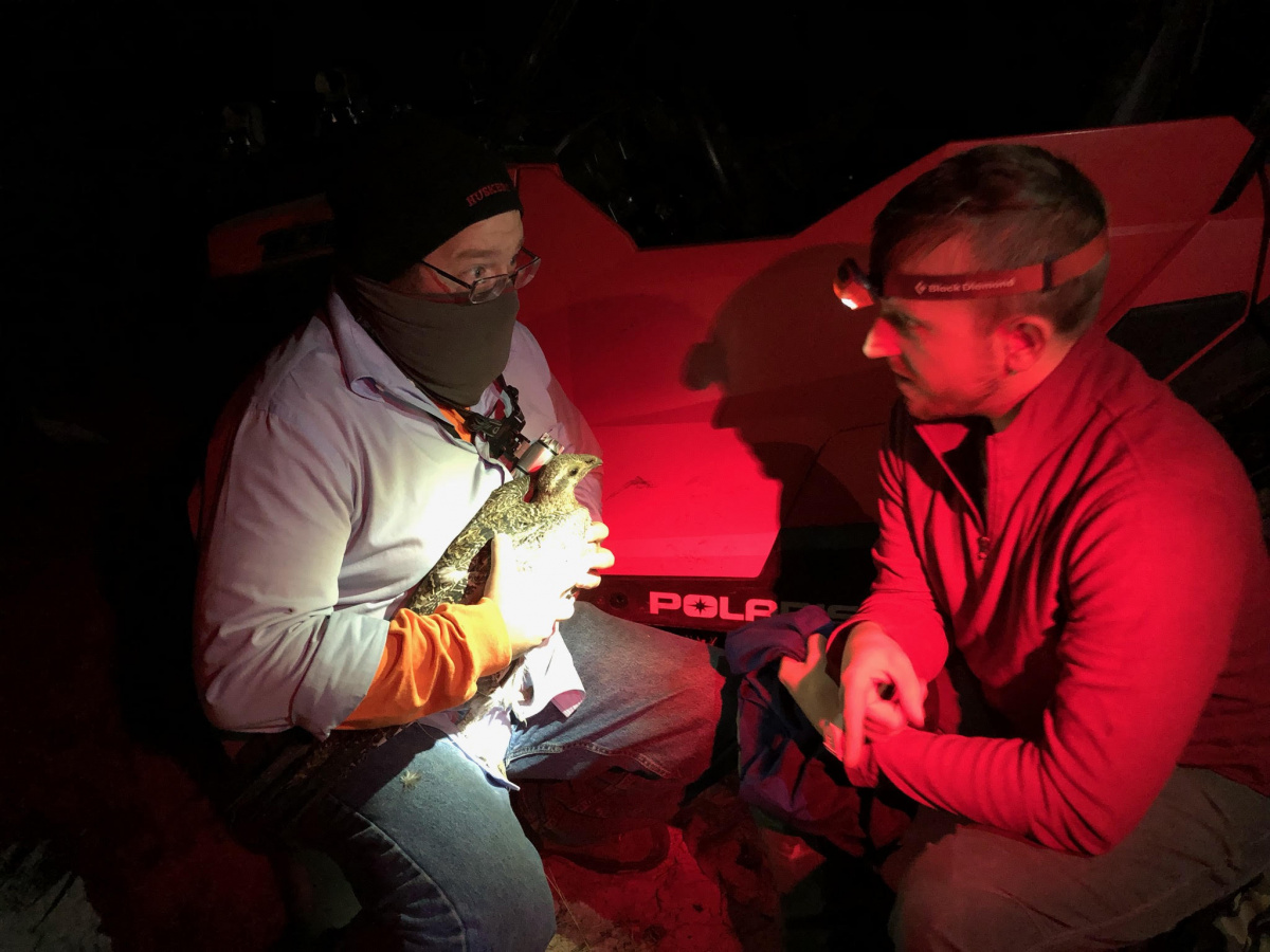
- Sage-grouse telemetry: To better understand the life history and habitat use by South Dakota’s unique sage-grouse population, SDFO’s wildlife biologist is collaborating with the U.S. Geological Survey to conduct telemetry studies, using collared birds to track and analyze movement, habitat selection and fate.
- Targeted grazing for ecologically appropriate weed control: Along with South Dakota State University and other partners, the BLM is investigating the use of targeted sheep grazing to control the spread of noxious and invasive plants in a prairie setting without the use of chemical agents.
Access to Public Land Provides Opportunities for Scientific Advancement
In addition to science activities in direct support of the land management questions, the ability of external scientists in a variety of fields to access public lands provides them with the opportunity for many other types of inquiry. Some scientific investigations happening on public lands in South Dakota include:
- Rich fossil resources on BLM land in South Dakota have attracted the attention of internationally renowned paleontologists Phil Manning and Victoria Egerton, who have led teams from Manchester University to conduct digs and present findings to the world.
- South Dakota State University, through an R&PP lease, uses pastures at Fort Meade Recreation Area to manage their research herd, carrying out grazing and animal science studies as well as educational activities.
- The Montana Climate Office has deployed two advanced soil moisture and meteorological monitoring stations on BLM lands in South Dakota as part of the Mesonet program. Mesonet is a cooperative statewide information system designed to support decision-making in agriculture, range and forested watershed contexts. High-frequency time series data from these sensors is available to the public in real time.
- Many graduate students have carried out their research on South Dakota’s BLM land, producing scientific understanding and promoting their careers.
Related Stories
- Recreation for all: Accessibility on Montana-Dakotas public lands
- North Central Montana District employees celebrate new adoption
- BLM Billings Field Office works with state agencies in Montana to conduct bat surveys
- Successful adoptions and community engagement at Upper Yellowstone WHB Event
- Community in action at Four Dances Recreation Area