
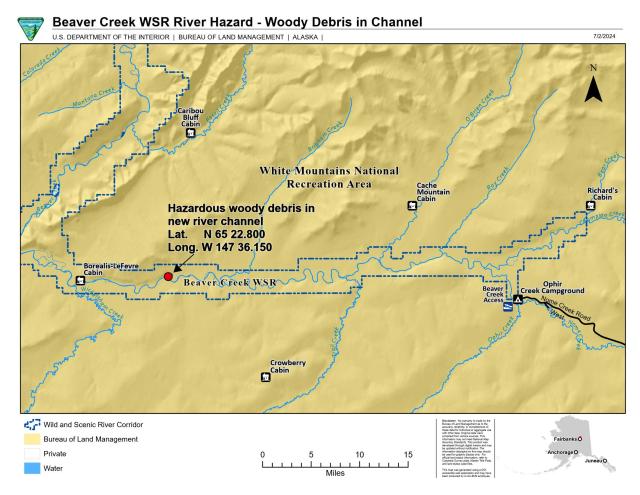
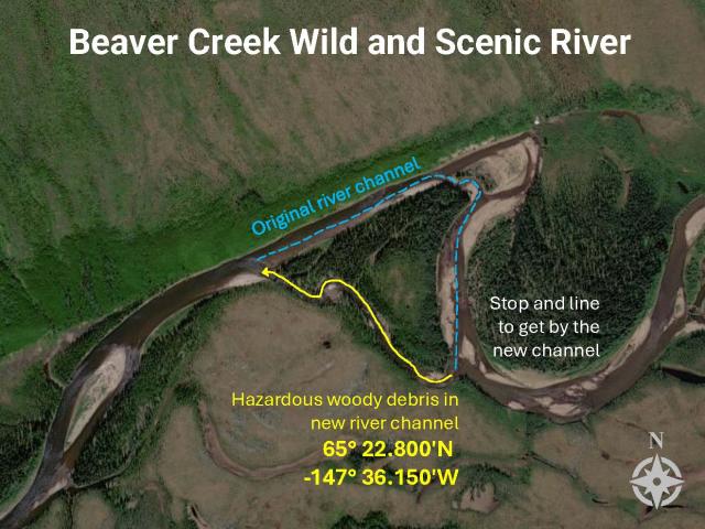
Upper Beaver Creek Wild and Scenic River hazardous new channel
This new river channel is a known hazard for boaters. The growing channel is creating a strong current that could draw boats into the new channel that is choked with hazardous woody debris.
Boaters should plan to scout the hazard and be prepared to line or portage gear around the hazard located at N 65° 22.800′ , W -147° 36.150′
New river channels can take years to clear debris and become safe for boating. Use caution.
Download Files
Publication Date
Region
Alaska
Organization
Collection: Public Room
Category: Map
Keywords
Beaver Creek Wild and Scenic River