
Rio Grande Wild and Scenic River | New Mexico
The Río Grande Wild and Scenic River, located within the Río Grande del Norte National Monument, includes 74 miles of the river as it passes through the 800-foot deep Río Grande Gorge. Flowing out of the snowcapped Rocky Mountains in Colorado, the river journeys 1,900 miles to the Gulf of America. Here the river flows in a rugged and scenic part of northern New Mexico. The river was made a part of the National Wild and Scenic River System in 1968; among the first eight rivers Congress designated as Wild and Scenic. The river gorge is home to numerous species of wildlife, including big horn sheep, river otter, and the Río Grande cutthroat trout.
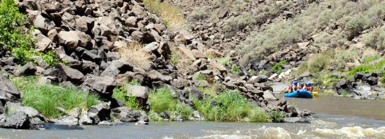
The Río Grande Wild and Scenic River provides a wide variety of recreational opportunities, luring anglers, hikers, artists, and whitewater boating enthusiasts. Two developed recreation areas are located along the river: Wild Rivers on the north and Orilla Verde in the south. In addition to these scenic recreation areas, a spectacular vista of the gorge can be viewed from the High Bridge Overlook where highway 64 crosses.
Accessibility Description (ABA/ADA)
- Trails are steep and hiking can be strenuous, most have an elevation gain anywhere between 300 – 800 feet and are two miles or more roundtrip. A parking area, some interpretive signage, and water spigots can be found at the trailheads
- To safely navigates these trails, visitors need to be able to handle steep, technical trail sections, have sturdy shoes, be able to carry drinking water in various weather conditions, and camp in primitive conditions.
Know Before You Go
Fees
- Río Grande Gorge Visitor Center
- Wild Rivers Recreation Area
- Wild Rivers Zimmerman Visitor Center
- Wild Rivers Backcountry Byway
Facilities
- Río Grande Gorge Visitor Center
- Wild Rivers Recreation Area
- Wild Rivers Zimmerman Visitor Center
- Wild Rivers Backcountry Byway
Nearby Amenities
- The Rio Grande Wild and Scenic River is 74 miles long, to find the nearest location to acquire food, gas, and water plan ahead or check the other webpages for the Rio Grande del Norte National Monument BLM sites.
Seasons/Hours
- Open year-round.
- Day Use Hours -- 6 a.m. to 10 p.m. An overnight camping fee is required for anyone choosing to remain in the recreation area beyond the day use hours.
- Winter conditions can be severe and make hiking/boating conditions difficult.
Special Rules
- Boating – Boating in this area can be extremely hazardous, requiring superior whitewater skills and specialized equipment. River access requires hiking boats and equipment into the gorge.
- All boaters must register by calling the River Program at the Taos Field Office (575) 758-8851 prior to launching.
- Fishing – Río Grande anglers are challenged by Río Grande Cutthroat, brown, and rainbow trout, as well as northern pike. The Red River supports a fishery of rainbow trout stocked by the Red River Fish Hatchery located upstream of the Recreation Area. To improve trout fisheries, Special Fishing Regulations are in effect.
- All anglers must have a valid New Mexico fishing license and a Wildlife Habitat Improvement Validation in their possession. Fishing licenses are sold in Questa. The daily bag and possession limit is 4 fish per license holder.
- Pets must be kept under control and on a leash at all times.
- Please observe quiet hours from 10 p.m. to 6 a.m. No amplified music allowed.
- Discharge of fireworks or firearms is prohibited within the Recreation Area.
- Pack out what you pack in!
Brochures, Maps, and Publications
- Río Grande del Norte National Monument Orilla Verde
- Rio Grande del Norte National Monument Wild Rivers Trail Map
- Rio Grande Segment Descriptions
Wildlife in Area
- Coyote
- Bighorn sheep
- Elk
- Mule deer
- Quail
- Bats
Contact Us

Activities


Addresses
Directions
The designated wild and scenic river corridor begins at the New Mexico/Colorado state line and ends at Rinconada, approximately 1 mile downstream of the Taos/Rio Arriba County line.
Fees
- Río Grande Gorge Visitor Center
- Wild Rivers Recreation Area
- Wild Rivers Zimmerman Visitor Center
- Wild Rivers Backcountry Byway
Stay Limit
Photo Album
