Red Rock Legacy Trail
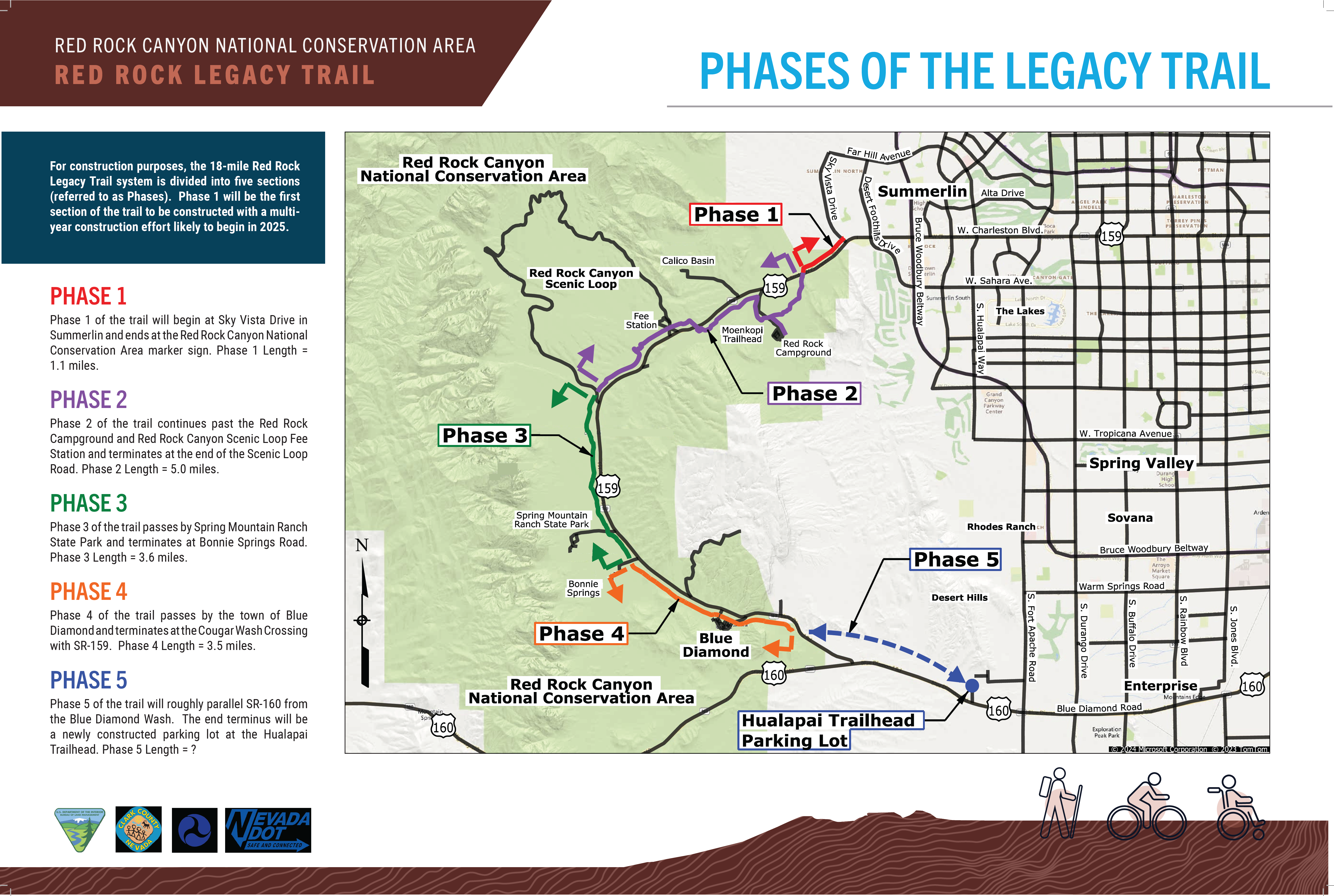
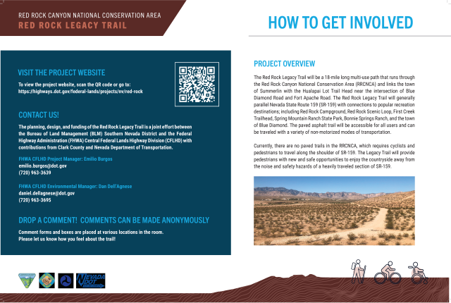
The Red Rock Legacy Trail project (Legacy Trail) proposes the construction of a paved multi-use path to improve safety and recreational opportunities for non-motorized users in the Red Rock Canyon National Conservation Area (RRCNCA) and the surrounding area. Visitation to the RRCNCA has increased greatly in recent years, and there is a need for safer shared access for pedestrians, cyclists, and vehicles. The proposed trail would improve safety along State Route (SR) 159 by providing an alternative to using the highway's shoulder. The route will connect approximately 20 miles of trail between the residential community of Summerlin with the Hualapai Trailhead parking lot just off SR-160, as well as provide upgrades to approximately six trailhead parking lots. The project is being delivered in five unique ‘Phases’ (see map below), with construction of Phase 1 anticipated to begin as early as 2025. The Federal Highway Administration-Central Federal Lands Highway Division (FHWA-CFLHD) is the lead agency for the project, partnering with the Bureau of Land Management (BLM), Clark County, and the Nevada Department of Transportation (NDOT) to plan, design, and implement the trail.
- Project Partners
-
The planning, design, and implementation of this project is made possible by a multidisciplinary team comprised of federal, state, and county entities.

- Purpose and Need
-
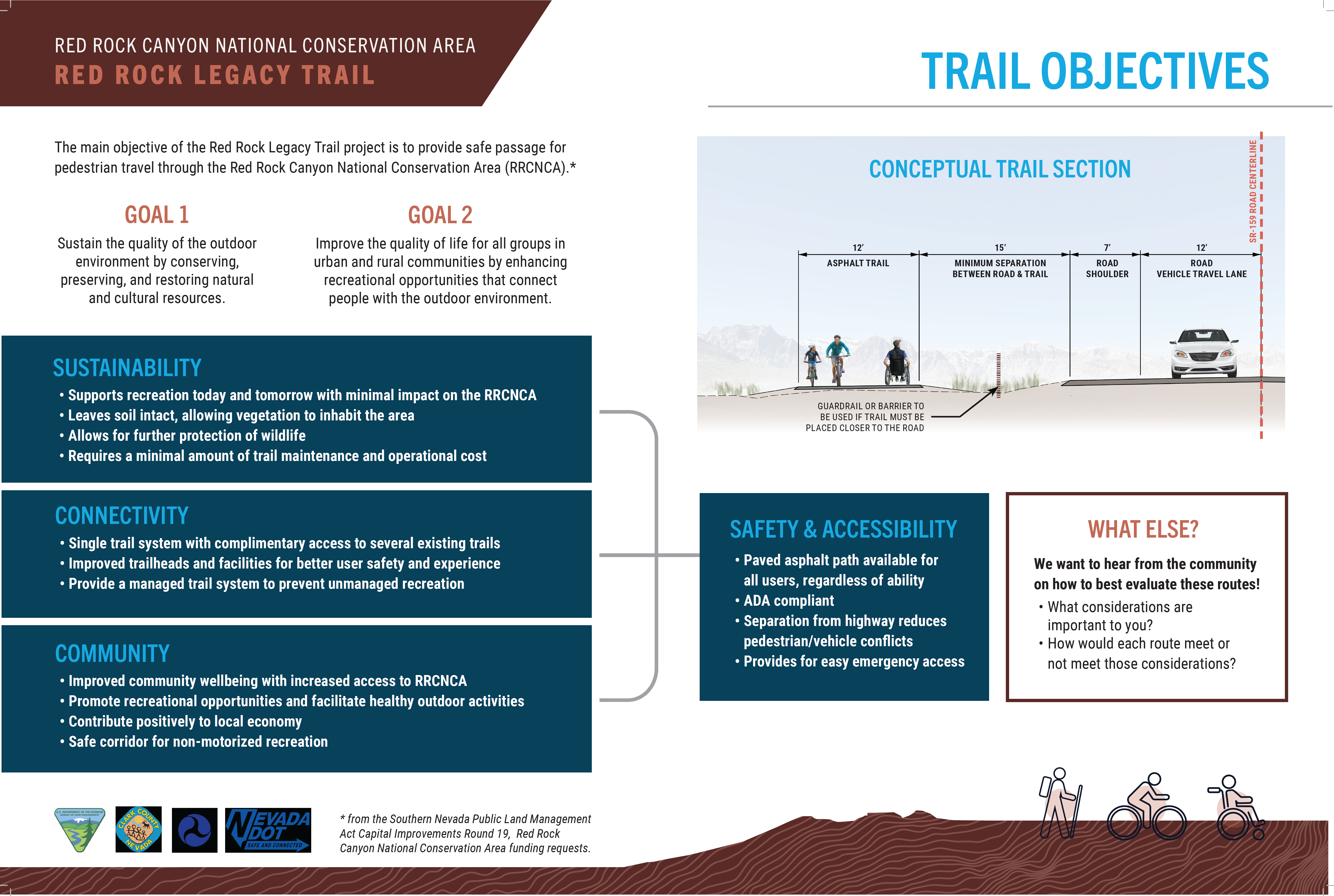
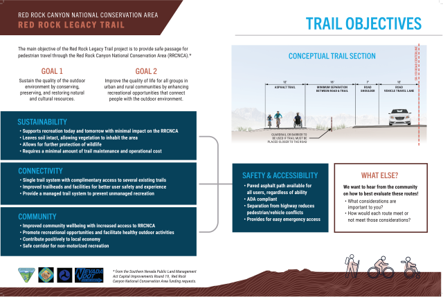
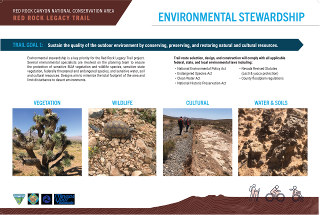
The purpose of this project is to construct a multi-use trail that roughly parallels SR-159 from West Charleston Boulevard to SR-160 and to improve access to various nodes within Red Rock Canyon National Conservation Area (RRCNCA). This need is consistent with the BLM’s Resource Management Plan for the RRCNCA, which calls for providing recreation opportunities that allow the public to enjoy and appreciate the unique natural setting of Red Rock Canyon, while conserving and protecting the RRCNCA’s natural resources. The trail system will provide safe access to the RRCNCA for non-motorized users.
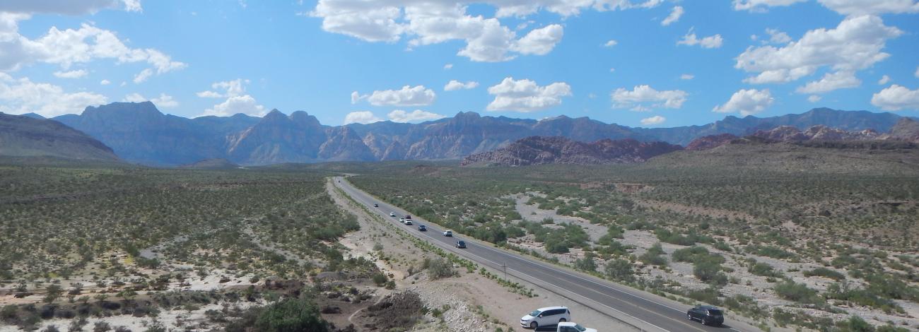
At present, the RRCNCA lacks paved off-road routes that would enable recreational users to circulate through the conservation area and conveniently connect to recreational hubs. Consequently, families and less experienced cyclists and runners often resort to using the highway shoulder. This practice poses a significant safety hazard, especially as the usage of State Routes 159 and 160 continues to rise. Our goal is to address this issue by creating safer pathways and enhancing connectivity for all visitors.
- Timeline
-
Each phase of the project has its own funding, design, and construction schedules, with each phase following a similar process spanning initial planning to final implementation and construction. Here is an overview of the current status per each phase:
Phase 1: Construction for Phase 1 is expected to begin as early as 2025.
Phases 2-5: These phases are in the early stages of planning and design. Specific construction timing will be announced as efforts progress.
Stay tuned for updates as we move forward!
- Funding
-
The Red Rock Legacy Trail is being funded by two main sources: 1) the Southern Nevada Public Lands Management Act of 1998 (SNPLMA) and 2) the Federal Lands Access Program (FLAP).
- The SNPLMA authorizes specific uses for revenues from the sale of public lands identified for disposal in the Las Vegas Valley. SNPLMA created an account with the United States Department of Treasury into which 85% of the revenue generated by eligible land sales are deposited. SNPLMA authorizes the Secretary of the Interior to expend the revenue in this account for projects that fall into expenditure categories, of which include the Red Rock Legacy Trail as a capital improvements project. Under SNPLMA, the remaining 15% of revenue is distributed to the State of Nevada’s general education program (5%) and to the Southern Nevada Water Authority (10%) for water treatment and transmission facility infrastructure in Clark County. Phases 2, 3, and 4 are funded under SNPLMA. Click here for a SNPLMA Overview.
- The FLAP is administered by the Department of Transportation’s Federal Highway Administration. It was established to improve transportation facilities that provide access to, are adjacent to, or are located within Federal lands. The Access Program supplements State and local resources for public roads, transit systems, and other transportation facilities, with an emphasis on high-use recreation sites and economic generators. Projects are selected by a Programming Decision Committee (PDC) established in each State. The PDCs request project applications through a call for projects. The frequency of the calls is established by the PDCs. Phases 1 and 5 are funded under the FLAP. Click here for information on the FLAP Program.
Planned development vs potential improvement:
- Trail construction and improvements are constrained by original funding application requests. All phases include a base scope for the design and construction of the trail itself. The extent of additional improvements to support trail safety and use, such as parking lots, trailheads, equestrian trails, interpretive signs, or e-bike charging stations, depend on what was accounted for in the funding application.
- Phase 1
-
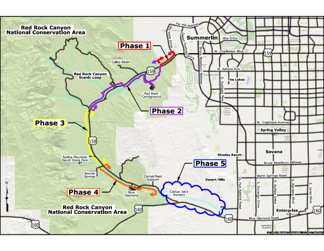
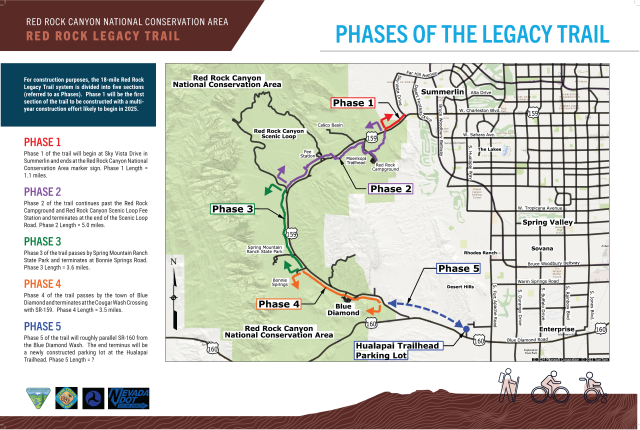
Phase 1 of the Legacy Trail will begin at Sky Vista Drive in the community of Summerlin and will continue along the northern side of SR-159 until the RRCNCA visitor sign on SR-159. The length of this portion is about 1.1 miles.
- Phase 2
-
Phase 2 of the Legacy Trail runs from the RRCNCA visitor sign and continues on the south side of SR-159 to the Red Rock Campground. From here, it loops back towards the highway, crosses to the northern side, and continues to the RRC Scenic Loop Fee Station. Phase 2 terminates at the end of the Scenic Loop Road. This segment is about 5 miles.
- Phase 3
-
Phase 3 of the Legacy Trail runs from the Scenic Loop Road exit to Bonnie Springs Road along the western side of SR-159, passing by Spring Mountain Ranch State Park. This segment will be about 3.6 miles.
- Phase 4
-
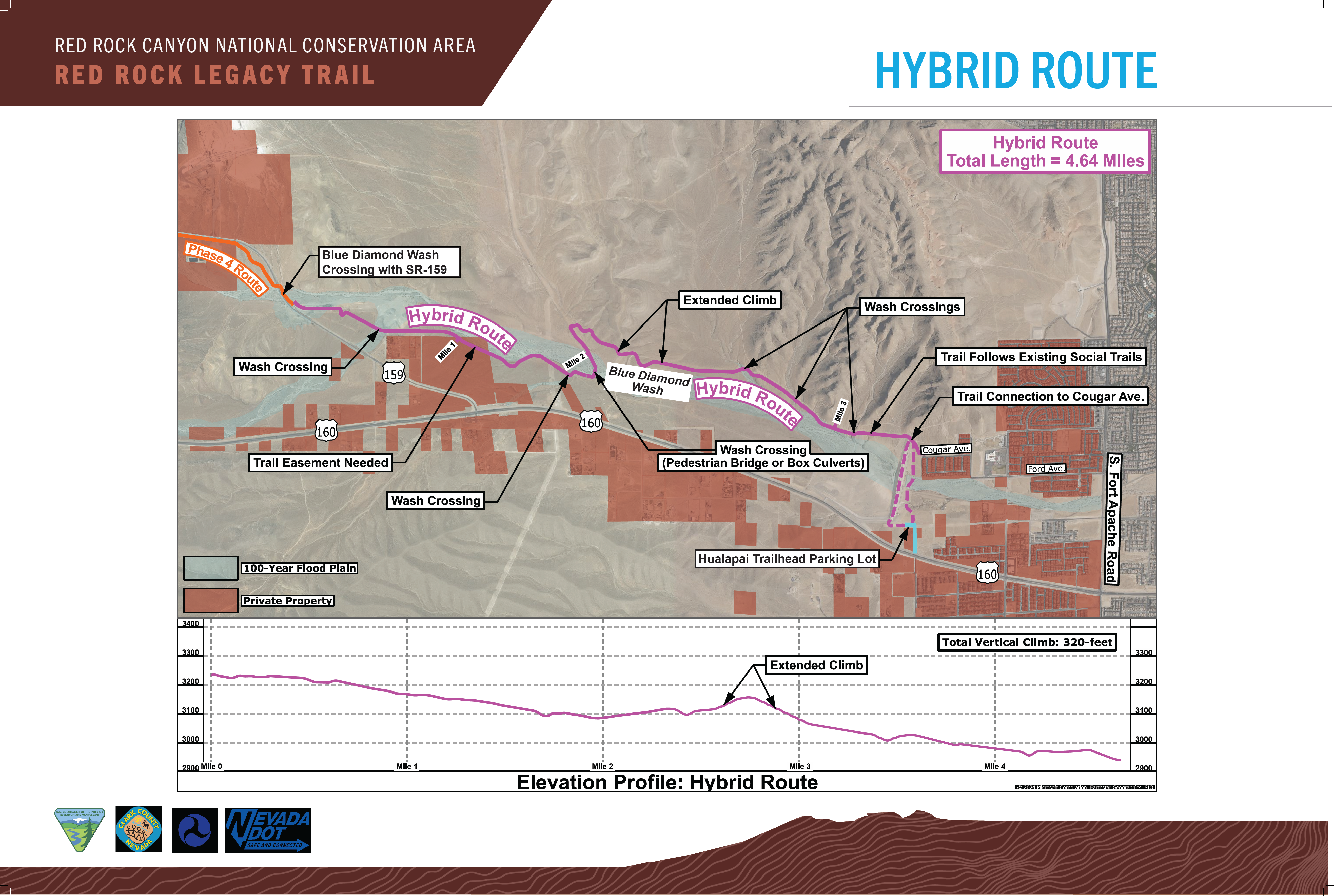
Phase 4 of the Legacy Trail runs from Bonnie Springs Road past the town of Blue Diamond and terminates at the Blue Diamond Wash crossing with SR-159 along the southwest side of SR-159. This segment will be about 3.5 miles.
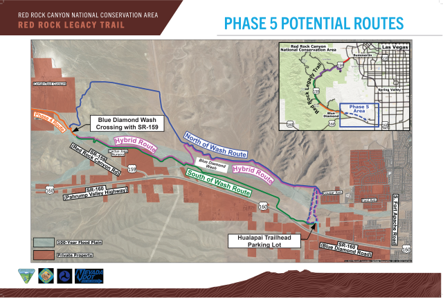
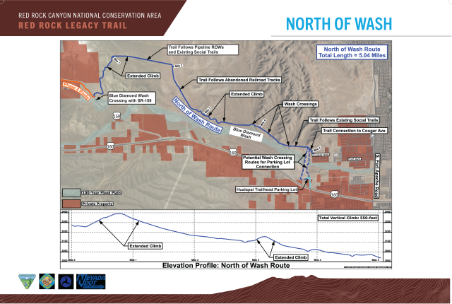
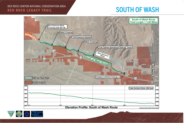
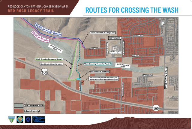
- Phase 5
-
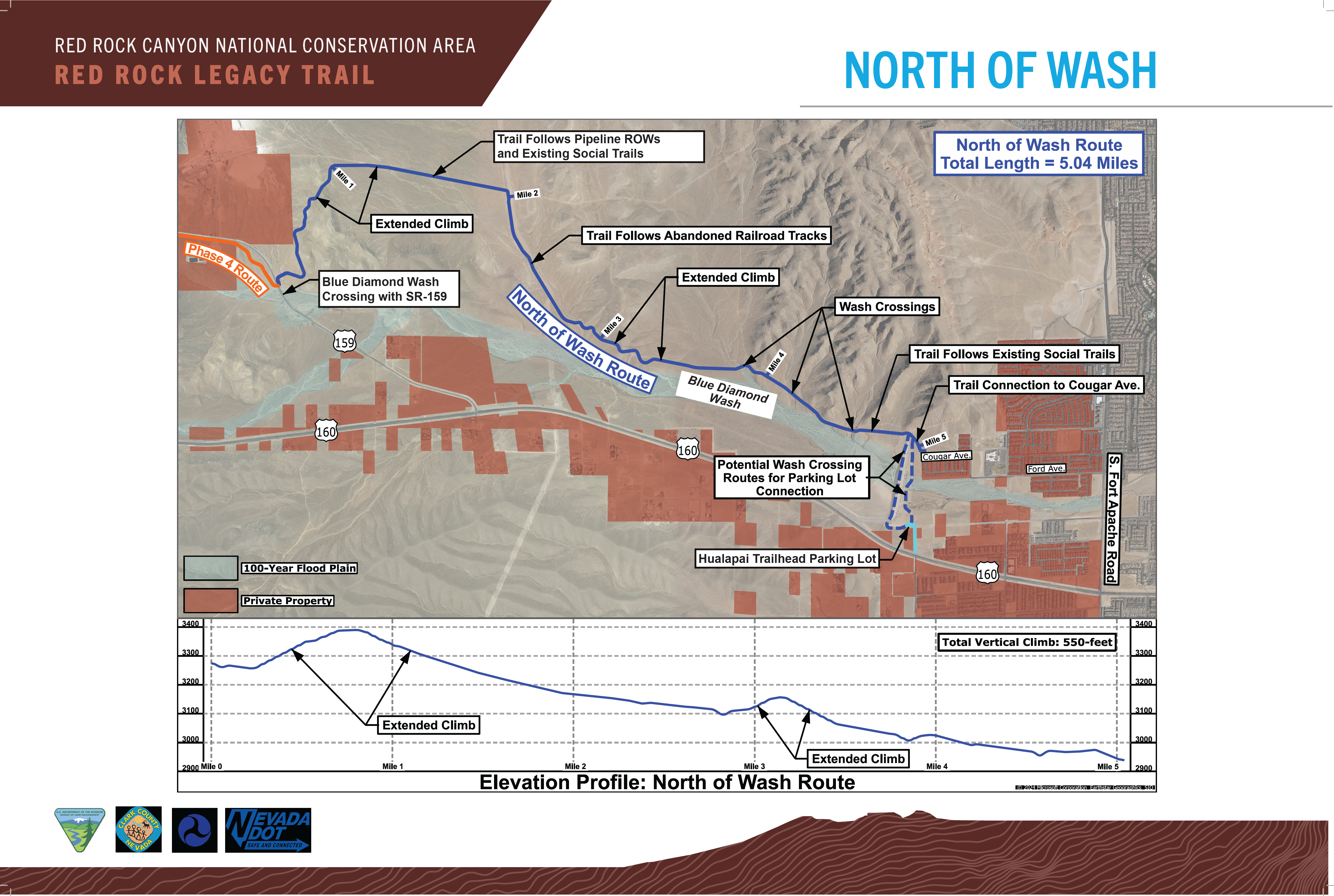
Phase 5 of the Legacy Trail runs from the RRCNCA visitor sign on SR-159 to the Blue Diamond Wash crossing with SR-159, connecting Phases 1 and 4. This portion is currently undergoing route analysis, with the total extent varying between 3.90 and 5.04 miles, dependent on which route is selected.
- How to get involved
-
There will be many opportunities for public involvement throughout the development of each phase of the Legacy Trail. Each phase will have an individual Environmental Assessment (EA) that analyzes the potential impacts of that section, in accordance with NEPA requirements. A signed Finding of No Significant Impact (FONSI) and Decision Record were published on March 22, 2024, for Phase 1 of the Legacy Trail and can be viewed online via the BLM’s National NEPA Register website: Phase 1 Project Site
The next anticipated EA will be for Phase 2. Production for this EA will commence in 2024, and notices for public comments and public meetings will be posted at the appropriate time. Updates regarding these comment periods or upcoming meetings will be posted to this site as well.
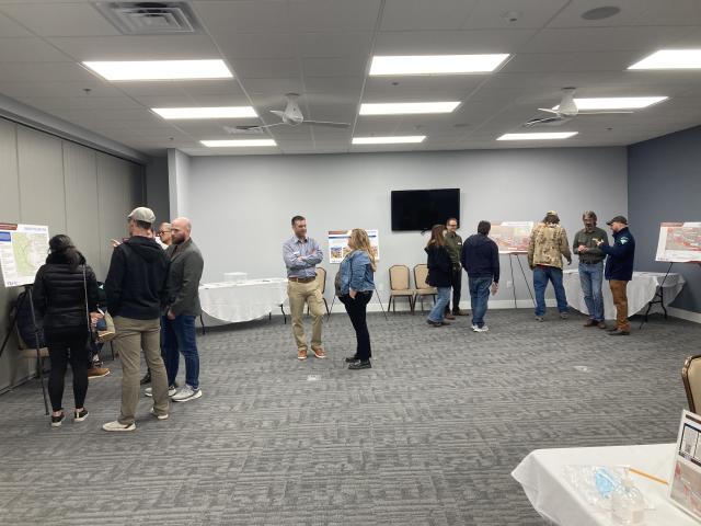
Other public meetings have been held to receive feedback on design planning. In February of 2024, a public open house was held regarding the route considerations for Phase 5. Comments received were considered along with technical factors to recommend a route for Phase 5.


For more information or questions regarding the Legacy Trail project, please contact [email protected].