
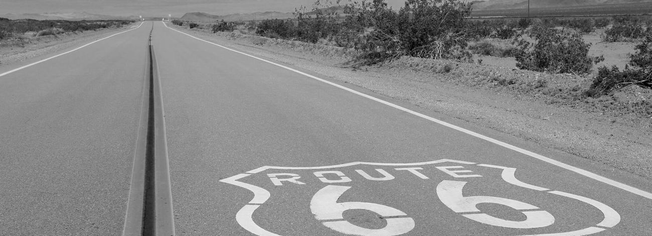
Historic Route 66 Needles to Barstow Scenic Byway
Historic Route 66 is significant as it was the nation’s first all-weather highway linking Chicago to Los Angeles. Known at the time of its establishment in November 1926 as U.S. Highway 66, the route was part of the first nationally designated highway system. Route 66 represents an outstanding example of the transition from dirt track to superhighway. Not only does Route 66 underscore the importance of the automobile as a technological achievement, but, perhaps equally important to the American psyche, it symbolized unprecedented freedom and mobility for every citizen who could afford to own and operate a car.
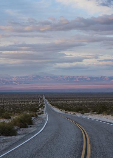
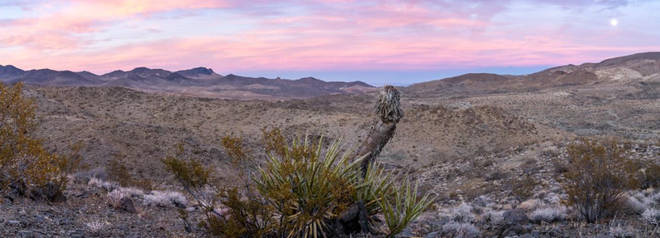
The byway is 178 miles through the Mojave Desert section of California Route 66 and follows segments of the National Old Trails Highway and the Santa Fe Trail. The byway connects with Arizona Route 66 All American Road at the Colorado River, 14 miles east of the town of Needles. The byway route heads west through 150 miles of virtually undeveloped land that today appears much like it did when Route 66 was commissioned in 1926. The national scenic byway passes through the desert towns of Needles, Goffs, Amboy, Ludlow, Newberry Springs, Daggett, and ends in Barstow and encompasses many historic sites including two Harvey Houses, a 1914 schoolhouse, museums, mining areas, motels, restaurants and gas stations. The route also includes three WWII Desert Training Center camps and bisects the Mojave Trails National Monument. Many activities on public lands can be accessed from Route 66.
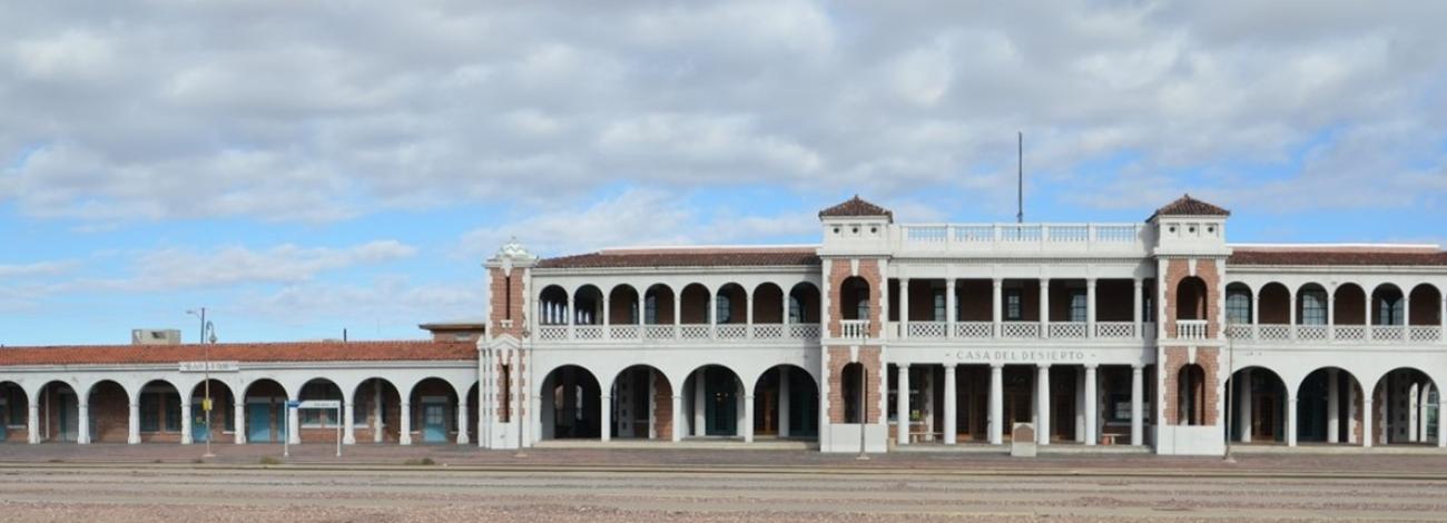
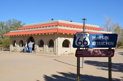
- 1. Harvey House and Route 66 Mother Road Museum
The Route 66 "Mother Road" Museum was dedicated on July 4, 2000 in the historic Casa del Desierto, Harvey House, in Barstow, California. The Museum displays a collection of historic photographs and artifacts related to Route 66 and the Mojave Desert Communities. Displays include development of the United States Route 66 from early pioneer trails, railroads, automotive history, businesses and sites.
Visitors making this roadside attraction a day destination or staying in the area longer can learn more about what to experience while on the Mojave Desert or on Route 66 from many handouts, books and knowledgeable docents. Because of greater interest, our technical resources and preservation efforts are building to offer better assistance.
On May 1, 2003 Hampton Inn Hotels designated the Harvey House Route 66 Mother Road Museum as a "Roadside Attraction" by officially posting a sign, one of "66" along the Route's 2,448 miles.
During the heyday of rail passenger service in the Western United States, Barstow boasted a splendid rail depot/restaurant/hotel complex called the "Casa del Desierto", House of the Desert. Completed in 1911, the Casa del Desierto was the fourth "Harvey House" built by the Atchinson, Topeka, and the Santa Fe Railway Company along its right-of-way and operated by the Fred Harvey Company. These Harvey Houses established an unparalleled standard of food service to the traveler, and entered the lore of American railroading and the West.
Address: 681 North First Avenue Barstow, CA 92311
- 2. Desert Discovery Center

The Desert Discovery Center provides year-round opportunities to learn about public lands and the rich history of the Mojave Desert. For more information call (760) 252-6060. Desertdiscoverycenter.com
For consistency, consider adding the address, phone number and email info as provided above.
The Desert Discovery Center also houses the ‘Old Woman Meteorite’, the second largest found in the United States which weighed 6,070 pounds when discovered in 1975.
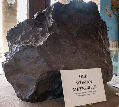
Measuring 38" long, 30" wide and 34" high, the meteorite is mostly composed of iron, contains about 6 percent nickel and has trace amounts of cobalt, phosphorus, chromium and sulphur.
Discovered in late 1975 in the southwestern portion of the Old Woman Mountains, the meteorite’s authenticity was verified by Dr. Roy Clarke of the Smithsonian Institute.
In 1980, the Smithsonian sent the meteorite back to the California Desert where it was placed on permanent display at the Desert Discovery Center in Barstow where it continues to amaze and inspire visitors.
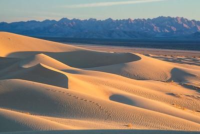
- 3. Mojave National Preserve
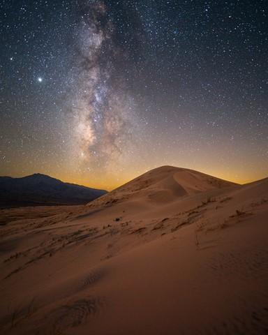
Photo: Kelso Sand Dunes. Courtesy of Jack Fusco. Singing sand dunes, volcanic cinder cones, lava tubes, Joshua tree forests, and carpets of wildflowers are all found at this 1.6 million acre park managed by the National Park Service.
Website: https://www.nps.gov/moja/index.htm
- 4. Wilderness
Wilderness areas provide opportunities for solitude or recreation and are part of BLM`s National Conservation Lands.
- 5. Mojave Trails National Monument
The Mojave Trails National Monument spans 1.6 million acres of federal lands, including more than 350,000 acres of already Congressionally-designated wilderness, managed by the Bureau of Land Management between Barstow and Needles, California. It is a stunning mosaic of rugged mountain ranges, ancient lava flows, and spectacular sand dunes. The monument contains the longest remaining undeveloped stretch of Route 66 and some of the best preserved sites from the World War II-era Desert Training Center. Connecting the Mojave National Preserve with Joshua Tree National Park, the Mojave Trails National Monument ensures the biological connectivity of this landscape while preserving recreational and traditional uses such as hunting and OHVing.
https://www.blm.gov/programs/national-conservation-lands/california/mojave-trails-national-monument
The Amboy Crater, formed of ash and cinders, is 250 feet high and 1,500 feet in diameter and is situated in one of the youngest volcanic fields in the United States. The site offers picnic tables, restroom facilities, a hiking trail to the rim with rest stations along the way, and an ADA ramada overlook for viewing.
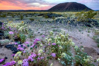
Amboy Crater was designated a National Natural Landmark in 1973 and is recognized for its visual and geological significance. Amboy Crater is an example of a very symmetrical volcanic cinder cone with a breach on the west side where basaltic lava poured out over a vast area of 24 square miles containing lava lakes, collapsed lava tubes and sinks, spatter cones and massive flows of basalt. Amboy Crater lies about halfway between Barstow and Needles (about 66 miles from each) off Historic Route 66 National Trails Highway.
Before You Go
Amboy Crater and the surrounding area are unique volcanic environments where temperatures can get very hot. Make sure to pack plenty of water and check the local weather before your trip.
National Weather Service forecast for Amboy Crater and surrounding areas.
- 6. Goffs Cultural Center
One of the largest archives on ranching, railroad, mining and military history in the Mojave Desert. Mdhca.org
Address: MDHCA
37198 Lanfair Road # G-15
Essex, CA 92332-9786Phone: 760-733-4482
Website: www.mdhca.org
email: [email protected]
- 7. Desert Training Center (DTC)
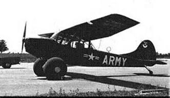
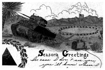
Between April 1942 and April 1944, more than one million soldiers and 60 armored, infantry and artillery divisions, fighter pilot and heavy bomber squadrons trained at the Desert Training Center/California Arizona Maneuver Area. They participated in what are considered some of the most realistic war games ever conducted under the harshest conditions imaginable. In a very real sense, many battles of World War II were won on these desert lands. The DTC/C-AMA signifies one the most extraordinary achievements in U.S. military history and honors the vision and leadership of General Patton, the more than one million U.S. soldiers who trained there, and the contributions of the public lands that more than 70 years ago helped Allied forces win World War II.
Read more about the Desert Training Center.
Watch a short documentary about the Desert Training Center.
- 8. 5 Mile Exit
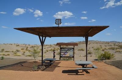
Located two miles west of the Colorado River off Interstate 40, 5-Mile exit reconnects travelers to historic Route 66. BLM’s interpretive site and kiosk on the southwest side of the overpass help guide visitors traveling on the Historic Route 66 National Scenic Byway.
History/cultural significance
Evolution of an American Icon
 For thousands of years, Native Americans developed a network of trails from spring to spring across the High Desert to trade with tribes along the Pacific Coast. By the 1850s, the U.S. Army was building roads over/near the trails to support westward expansion. Railroads followed the trails where feasible to get access to water and supplies. New wagon roads were built to follow the railroads, and many of these roads would become routes for automobiles.
The first car crossed the High Desert in 1903, however, the desert’s sandy roads and steep grades were difficult for cars and in 1911, San Bernardino County built the first road for cars to cross the Mojave Desert.
In 1912, the Old Trails Road, later named National Old Trails Road, was built and by 1918, it was the preferred transcontinental auto route from New York to Los Angeles.
Between 1910 and 1920, vehicle ownership grew from 500,000 to almost 10 million and a national highway system was needed to replace America’s disjointed network of badly maintained roads and trails.
Congress first introduced legislation for public highways in 1916 (Federal Aid Highway Act). The Act was revised in 1921 and again in 1925, which finally authorized construction of a national highway system.
On November 11, 1926, the Chicago to Los Angeles route, was officially designated U.S. Highway 66, more popularly known as Route 66. The route extended 2,448 miles across eight states beginning in Chicago, Illinois and ending in Santa Monica, California. The “Mother Road” was born.
From the outset, highway officials intended U.S. 66 to connect the main streets of rural and urban communities as many small towns did not have access to a major national thoroughfare.
Route 66 became one of the nation’s principal east-west arteries and has undergone many improvements over its lifetime. During the late 1920s and 1930s, work progressed to realign and straighten the highway and the road was fully paved by 1938.
Route 66 was a major path for those who migrated west, especially during the Dust Bowl of the 1930s.

Many families from Oklahoma, Arkansas, Kansas and Texas headed west for agricultural jobs in California. John Steinbeck’s The Grapes of Wrath nicknamed Route 66 as the “Mother Road”.
Route 66 provided some relief to communities located along the highway during the Great Depression. It passed through numerous small towns and, with the growing traffic on the highway, helped create the rise of mom-and-pop businesses, such as service stations, restaurants, hotels, motels and motor courts.
During World War II, the fully paved highway was one of the main roads used to move equipment, troops, and supplies to support military training operations for the Desert Training Center and other war-related industries in California.
 Route 66 experienced its greatest post-war popularity during the 1950s and 1960s, as it became the main highway for vacationers headed to California. Route 66 became an icon of free-spirited independence, linking the United States across the Rocky Mountain Divide to the Pacific Ocean.
The romance and nostalgia of Route 66 is immortalized in popular culture in movies, songs such as Bobby Troup’s 1946 hit Get Your Kicks on Route 66, and the 1960s Route 66 television show.
End of an Era
 While many improvements had been done to roads within the National Highway System, including Route 66, President Dwight Eisenhower supported construction of a national Interstate System to efficiently move troops across the country and on June 29, 1956, he signed the Federal-Aid Highway Act/
National Interstate and Defense Highways Act into law. Interstate 40 was completed in 1979 and Route 66 was removed from the U.S. Highway System in June 1985.
Protection for a Historic Symbol
 Although U.S. Highway 66 was decommissioned, memories of Route 66 live on through shared adventures and challenges of traveling on the Mother Road. Advocates have formed coalitions throughout the country to promote and preserve the history of our beloved Mother Road. Their actions continue to protect the significant structures, features and artifacts along Route 66.
On February 24, 2021, the Federal Highway Administration’s National Scenic Byways Program designated the section California Historic Route 66 between Needles and Barstow a National Scenic Byway, following eight years of outreach and collaboration, lead by the California Historic Route 66 Association (CHR66A) and the Bureau of Land Management (BLM) California Desert District’s Barstow and Needles.