
Avery Island, Louisiana
This week's Record of the Week features Avery Island in Township 13 South, Range 5 East in the Louisiana Meridian. Labeled by its original French name, Petite Anse Island, on the plat below, the island was later acquired by the eponymous Avery family. Avery Island is a salt dome that rises dramatically from low, flat wetlands to a height of 163 feet above mean sea level, making it the highest point on the Gulf Coast. Read more on ArcGIS Story Maps.
The GLO website provides live access to Federal land conveyance records for the Public Land States, including image access to more than 12 million federal land title records issued between 1788 and the present.
The site also hosts images of survey plats and field notes, land status records, and control document index records, and is the most visited website in the Department of the Interior. Visit glorecords.blm.gov for more information.
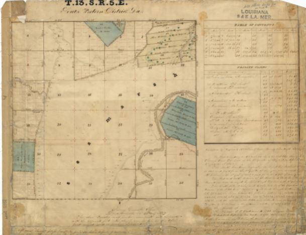
Original Survey Plat
Related Stories
- Monument map earns ‘finalist’ honors in global GIS awards
- Families “bug out” at Meadowood’s night of nature and discovery
- Phosphate mining in Florida sustains supply chains, sets standards
- BLM Eastern States enhances campsites on Black Duck Lake
- Recreation for all: public land accessibility in our Eastern States
Office
5275 Leesburg Pike
Falls Church, VA 22041
United States