
BLM plans fall and winter prescribed burning
KLAMATH FALLS, Ore. – As fall weather brings shorter days and cooler temperatures, the BLM is preparing for fall and winter prescribed burning. Fuels specialists may begin ignitions as early as October 15, if conditions are favorable.
The Klamath Falls Field Office hopes to accomplish up to 750 acres of pile burning. Ignitions are expected to continue over the next several months as weather conditions allow. Prescribed burn projects are planned in the following areas:
- Timber Sale Landing Piles. Locations are 5 to 25 miles west/southwest of Keno. Total of 150 acres. Legal locations are T 40S R 7E Sections 17, 21, and 29.
- Pleasant Valley Thinning Piles. Location 10 Miles southwest of Keno. Total of 50 acres. Legal locations are T 41N R 7E Section 7.
- Machine Piles. Locations are in the Alkali Springs area of the Gerber Block, 20 miles southeast of Bonanza. Total of 50 acres. Legal locations are T 41N R 14E Sections 10, 11, and 12.
- Oshea Spring Hand Piles. Locations are 13 Miles SE of Bonanza. Total of 200 acres. Legal locations are T 39S R 14E Sections 19, 28 and T 39S R 13E Section 24.
- Hand Piles and Machine Piles. Locations are 5 to 25 miles southeast and northeast of Klamath Falls. Total of 300 acres. Legal locations are Bryant Mountain T 41S R 13E Section 18; Stukel Mountain Hand Piles T 40S R 10E Sections 3, 4, and 14; and Bly Mountain Golden Fire Machine Piles T 37S R 11E Sections 26, 35.
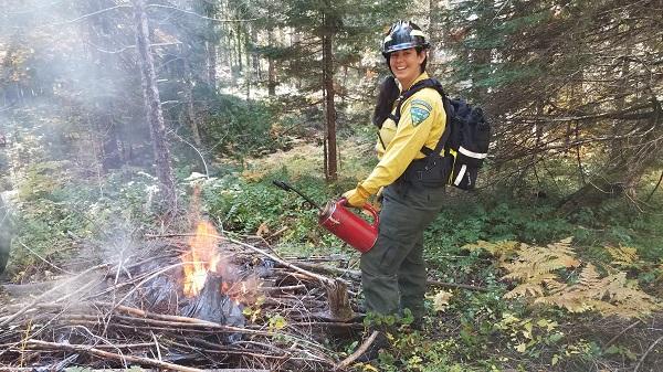
Prescribed burning reduces hazardous fuels which can burn during wildfires. The piles are concentrations of leftover materials from previous thinning projects. Where possible, material was first offered for firewood, commercial sale, or biomass use. Some material was also scattered to rehabilitate sites and close user-created routes.
Each project can take several days or several weeks to complete, depending on the size. Crews will move between each project area based on site-specific weather. Main roads within the project areas will be signed to inform residents and the public of planned prescribed fire activity. No road closures or delays are expected.
All prescribed burning is highly dependent on favorable temperature, moisture, and wind conditions. Each of these prescribed burns will only be implemented if the conditions are right to meet the objectives of the burn. All prescribed burn areas will be patrolled during and following ignitions.
Prescribed burns are completed in cooperation with the Oregon Department of Forestry smoke management plan. Piles may smolder, burn, and produce smoke for several days after ignition. Efforts will be made to minimize smoke impacts to nearby communities.
What does this mean for you?
During prescribed burns, smoke may settle in low-lying areas overnight.
- All residents are encouraged to close windows at night to avoid smoke impacts
- When driving in smoky areas, drivers should slow down and turn on headlights
- If you have heart or lung disease, asthma, or other chronic conditions, ask your doctor about how to protect yourself from smoke
For more information on prescribed burning or for information specific to the BLM Klamath Falls Field Office, call 541-883-6916.
The BLM manages about 245 million acres of public land located primarily in 12 western states, including Alaska, on behalf of the American people. The BLM also administers 700 million acres of sub-surface mineral estate throughout the nation. Our mission is to sustain the health, diversity, and productivity of America’s public lands for the use and enjoyment of present and future generations.